Landing in Alice Springs (Central Australia), the next portion of our trip would be camping in rooftop tents in the Red Centre atop a 4×4 Wicked Desert Sands truck. We had expected dry deserts and loose red dust, but found ourselves in a situation the area has not seen since 1988 – post heavy rains and flooding! It had been raining here for 3 weeks, filling up lakes and steams that are usually dry, closing roads, flooding campgrounds, and creating havoc in the supply chain. Welcome to Part 4 of our Australia adventure!
“Drought. Fire. Flood. Times of hardship followed by times of plenty. It’s a cycle as ancient as the country itself, driven in recent decades to unparalleled extremes by anthropogenic climate change. Inseparable, capricious, and elemental, fire and water are the twin creators of Australia’s landscape (Mark McKenna, 2025).”
We had witnessed the effects of fire on Kangaroo Island. Now, on to flooding. We arrived on a drizzly day, as the taxi driver expressed how it is NEVER this green and how lucky we were.
The greens mixed with the red rocks and dirt was simply stunning, but not the typical way that people see the Red Centre. Our tour would also become a guided tour of the effects of high waters, “High Times with Hydrologist Heath.” It’s not every Outback tour that gets its own personal guide, as we continued on with our Alaskan friends.
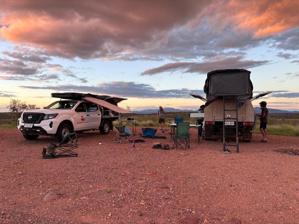
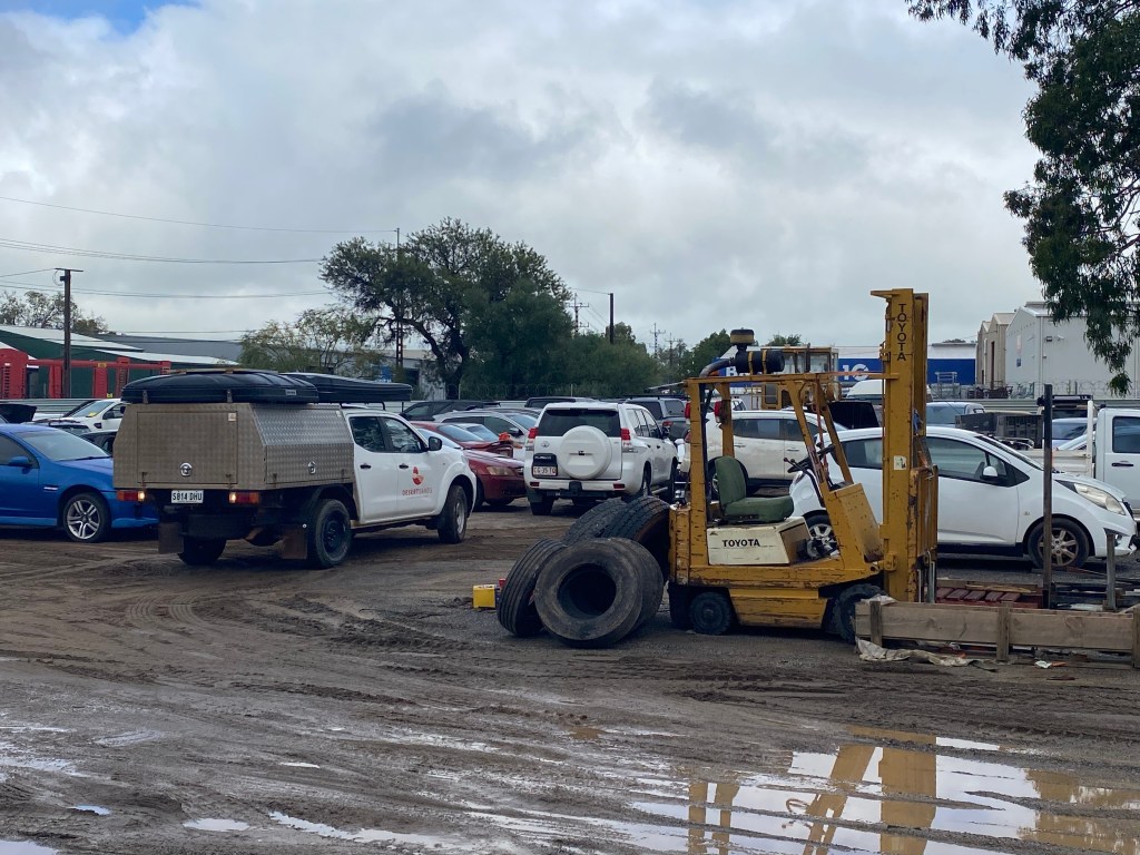
When the taxi dropped us off at what looked like a cross between a car dealership, a mechanic’s garage, and a wrecking yard—set in the mud with rain pouring down—let’s just say we weren’t entirely sure what we had signed up for! But yes, this was the right place, and before long we were handed the keys to our two Wicked vehicles, given minimal instruction, and sent on our way.
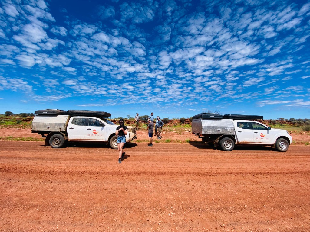
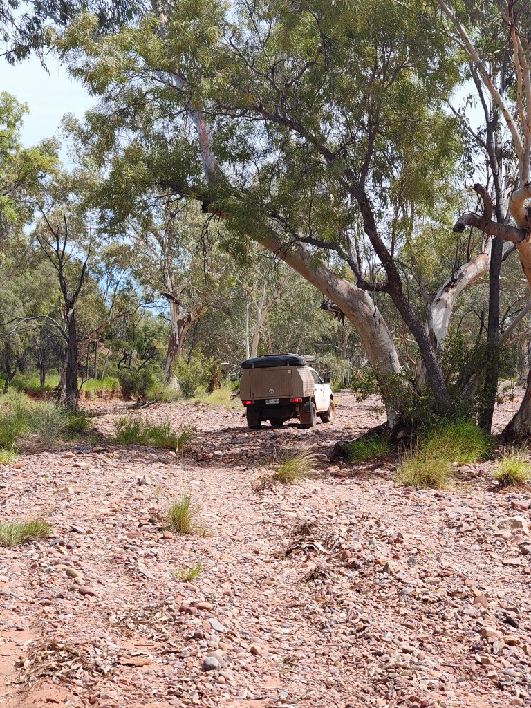
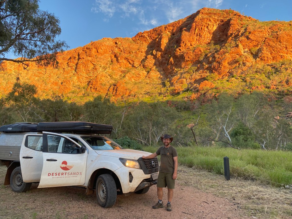
Our rigs were four-door Nissan diesel 4×4 trucks fitted with custom diamond-plated camper boxes on the back and two pop-up tents mounted on top. They came equipped with an onboard 12-volt system powered by a solar panel to run the fridge, a water tank with pump, and a hefty diesel tank with a range of nearly 750 kilometers. At the Info Center, we brainstormed with the staff where to go, as our initial plan needed to evolve due to the weather. However, the Meerenie Road loop was just about to open and he was willing to let us buy a pass with warnings about stream crossings in our future. Off to the grocery store to load up, bought some bedding at Kmart (which we later donated back), and filled up the fuel tank.
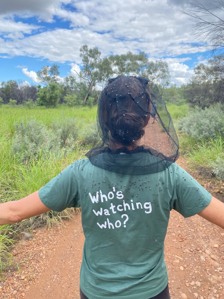
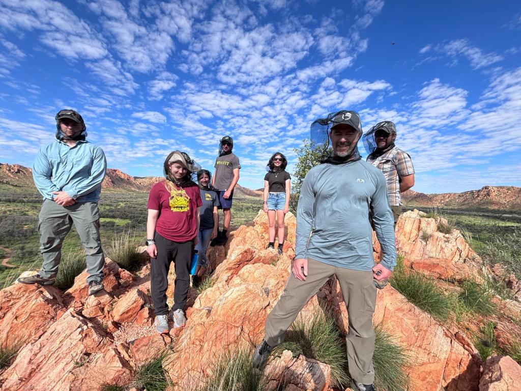
Needing water and good clean, we stayed at G’day Mate Tourist Park in Alice Springs, where Heath presented us with an awesome and necessary gift – fly head nets. The incessant buzzing of flies from morning until sunset became the norm for our time here, but we pushed on exploring and doing our food prep either inside the truck or after dark.
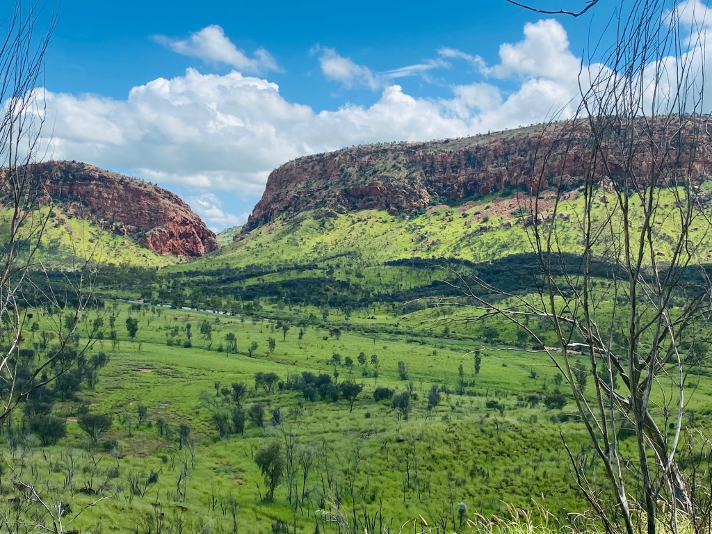
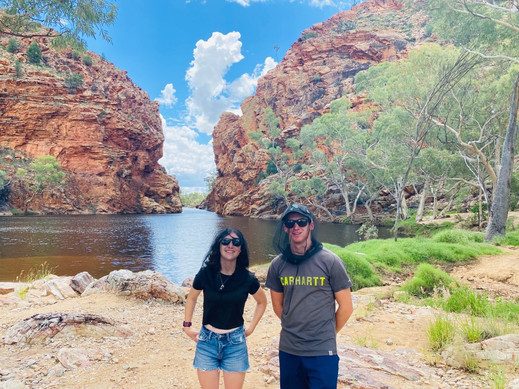
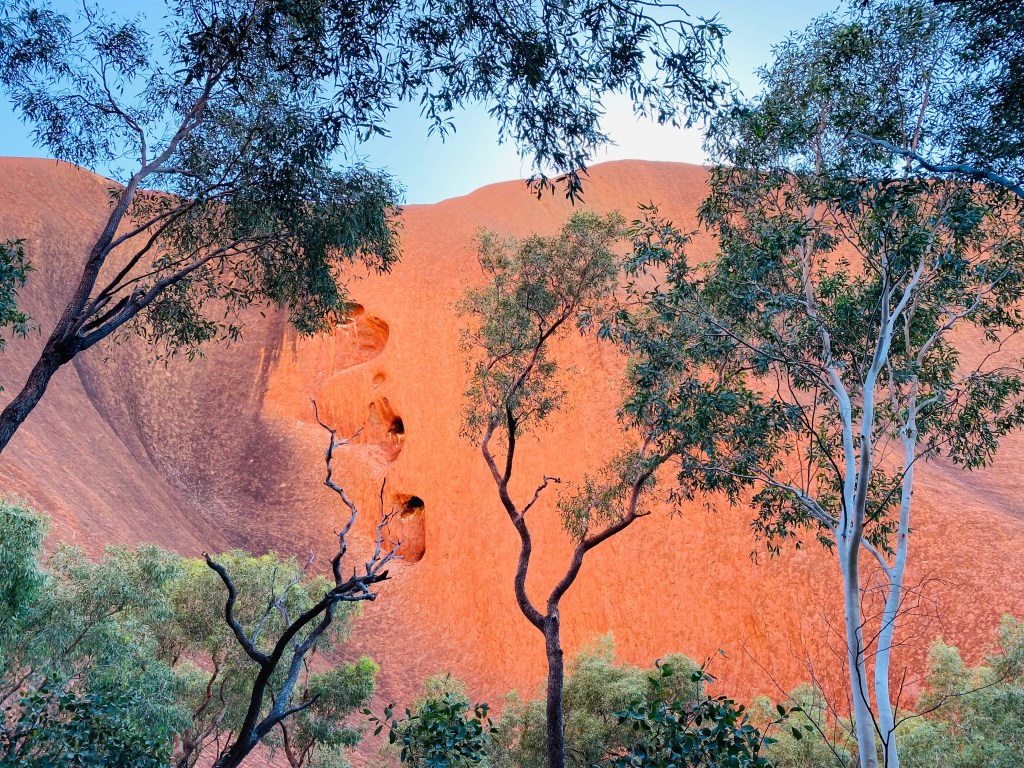
The next morning, we headed off toward the flooded West MacDonnell Ranges (Tjoritja), a spectacular landscape soon to be World Heritage listed. Stretching more than 640 kilometers east to west, the ranges glow with layers of sunburnt orange rock. Estimated to be at least 340 million years old, they were formed when two tectonic plates collided, creating mountains once thought to rival the height of the Himalayas. Over countless millennia, wind and water have slowly worn them down, exposing the rugged skeleton of what was once a massive mountain range.
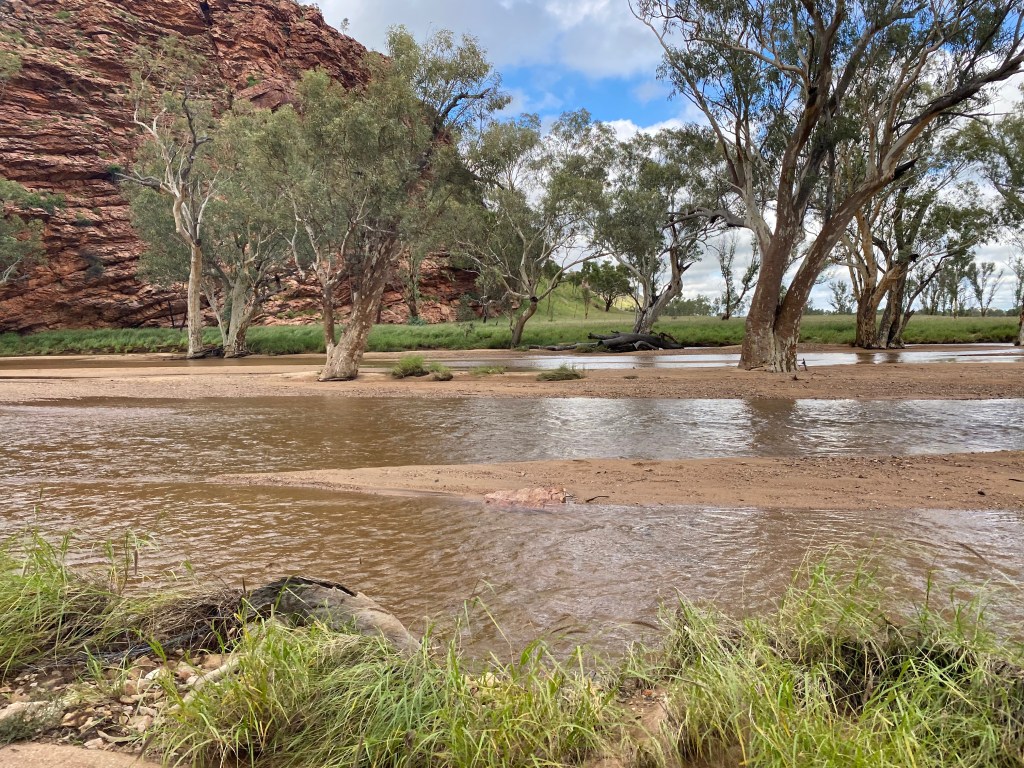
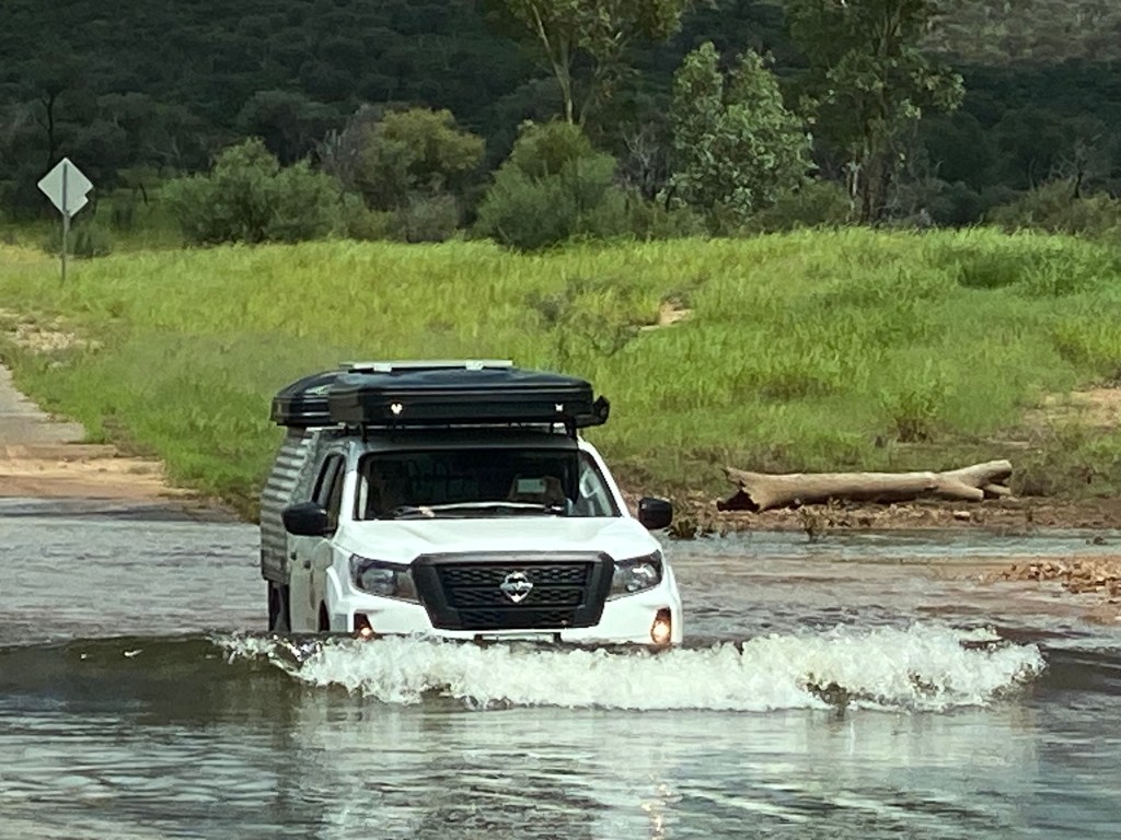
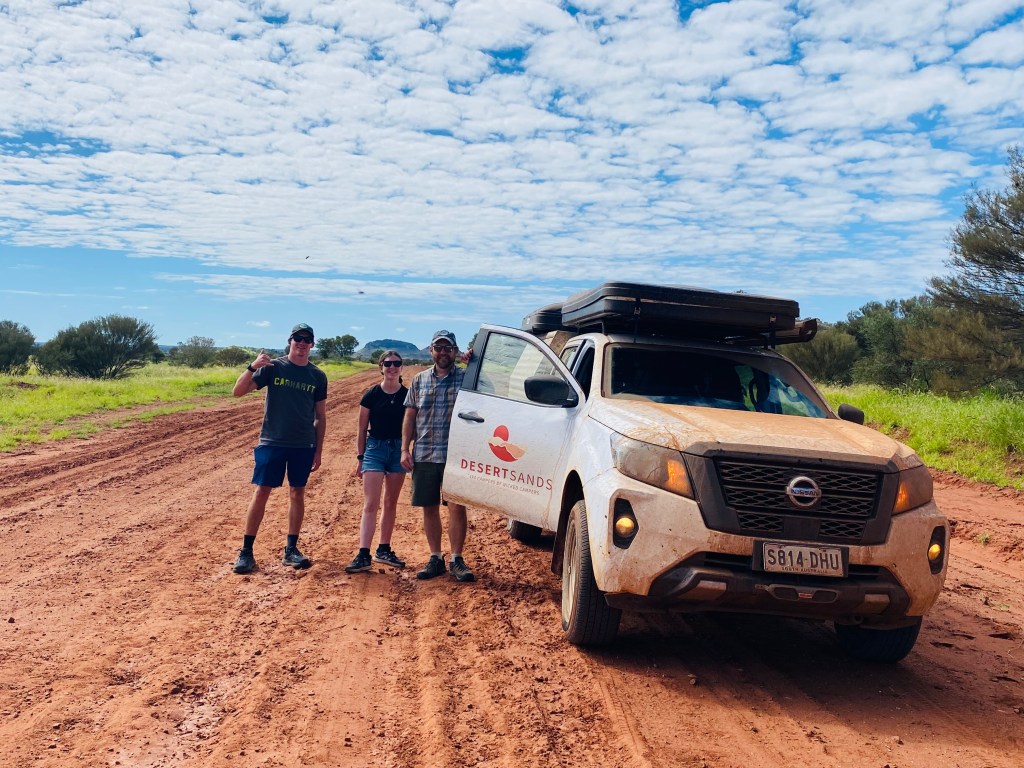
Our choice of vehicle turned out to be spot on. I quickly lost count of how many river crossings we tackled, with the water occasionally creeping almost up to the hood.
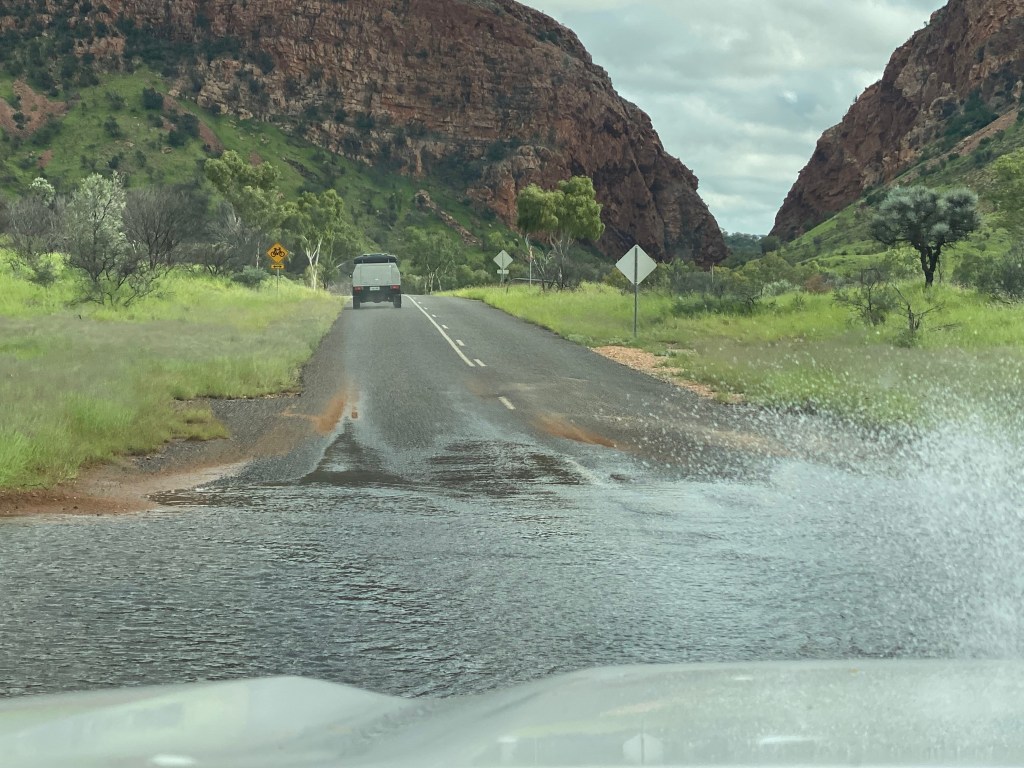
Every new crossing had us laughing harder than the last, and I’m pretty sure Daddy Chris and Papa Heath were having the time of their lives behind the wheel as they transformed our once-white rigs into a lovely shade of outback orange.
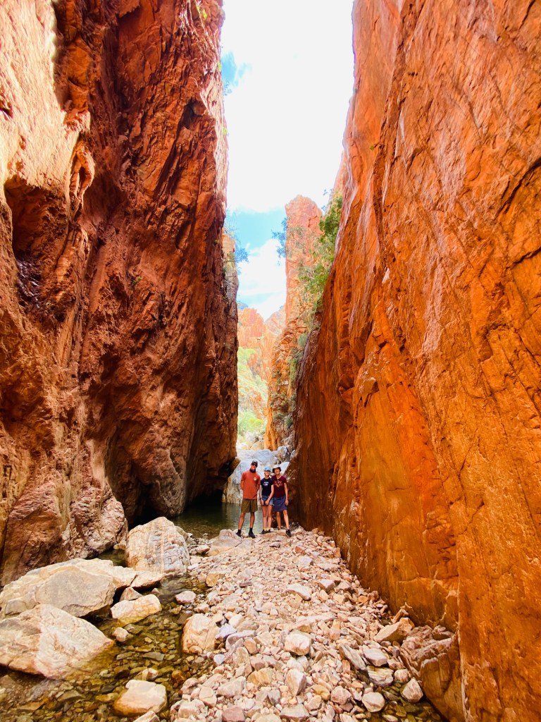
We explored a series of gaps, gorges, and waterholes scattered along the route, each with its own distinct beauty. At Simpsons Gap, a dramatic natural break in the range, we spotted a lone black-footed rock wallaby perched high among the debris left behind by the recent deluge. Everywhere we stopped, we found ourselves commenting on the astonishing height of the flood debris, with water levels still running remarkably high.
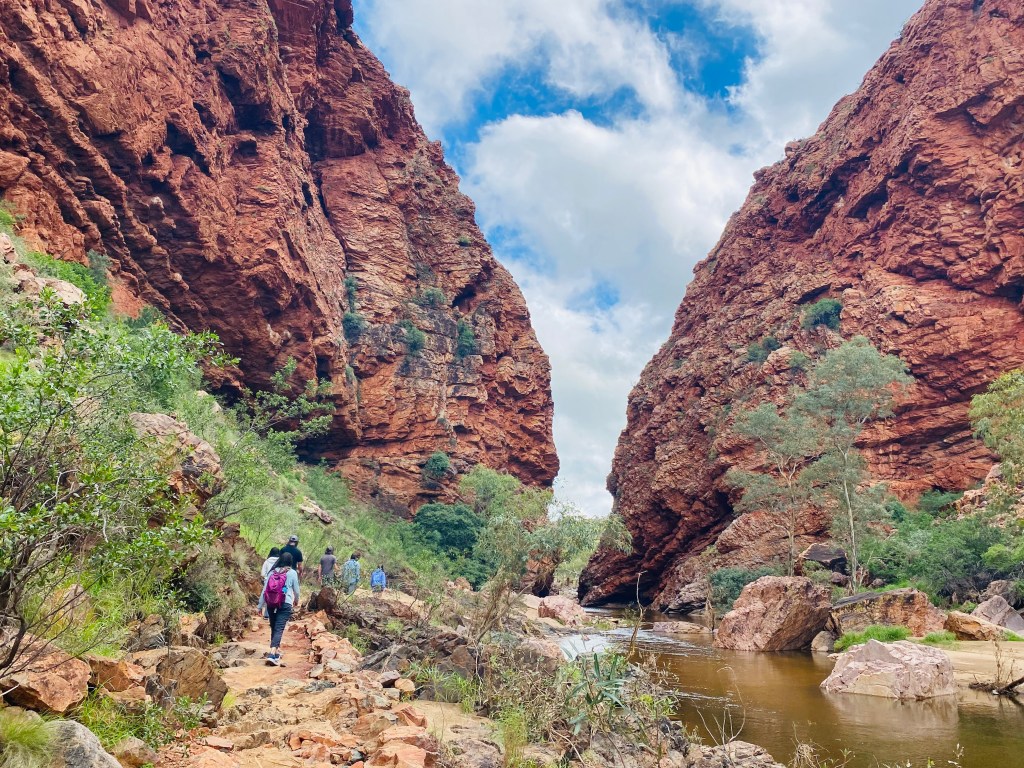
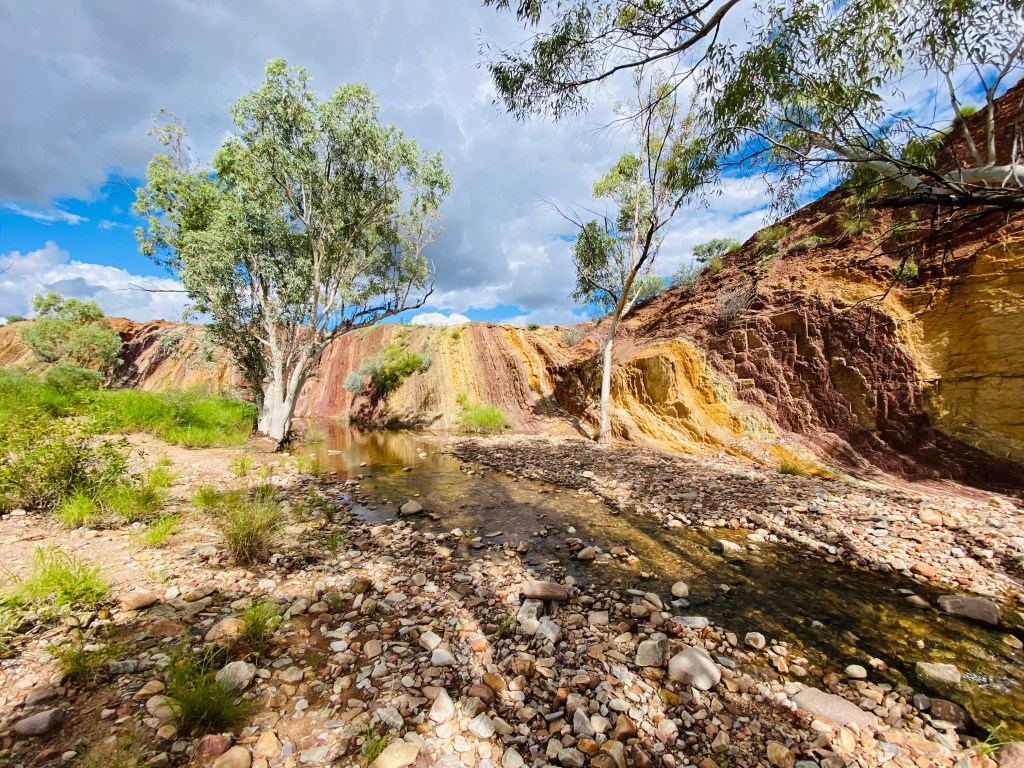
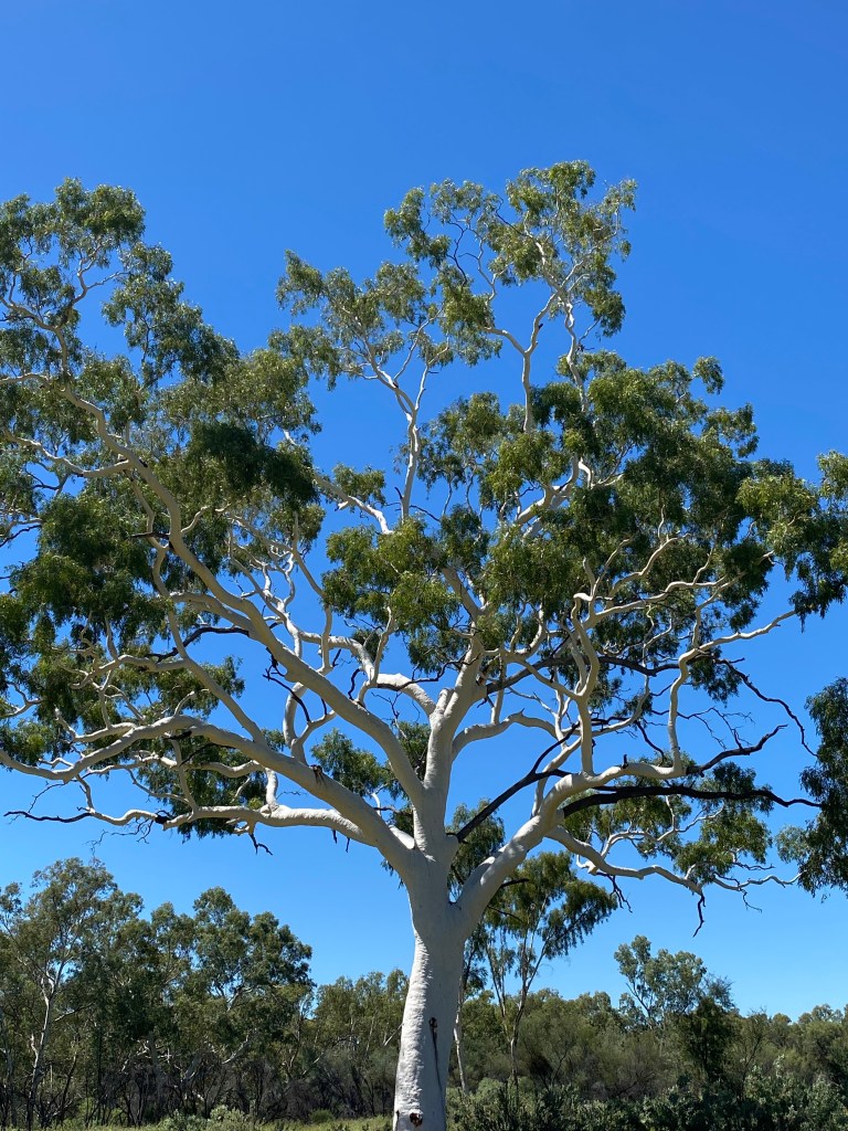
We hiked the short Ghost Gum Trail beneath picturesque white eucalyptus trees before climbing Cassia Hill for sweeping views—enjoyed in between swatting at the ever-increasing hordes of flies that multiplied with every drop of sweat. Heath took a swim at Ellery Creek Big Hole, the largest permanent waterhole in Central Australia, while the Ochre Pits revealed beautiful layers of natural pigments in the cliff face, mined and used by local Aboriginal people for generations in ceremonies, decoration, and painting.
After a quick stream crossing and short walk, we arrived at Serpentine Gorge, yet another stunning geological wonder. We also squeezed in a bit of off-roading at the Finke 4WD Campground, where we had originally planned to stay for the night, but with daylight left and momentum on our side, we decided to keep pushing onward and put a few more miles behind us in our fly-free vehicles.
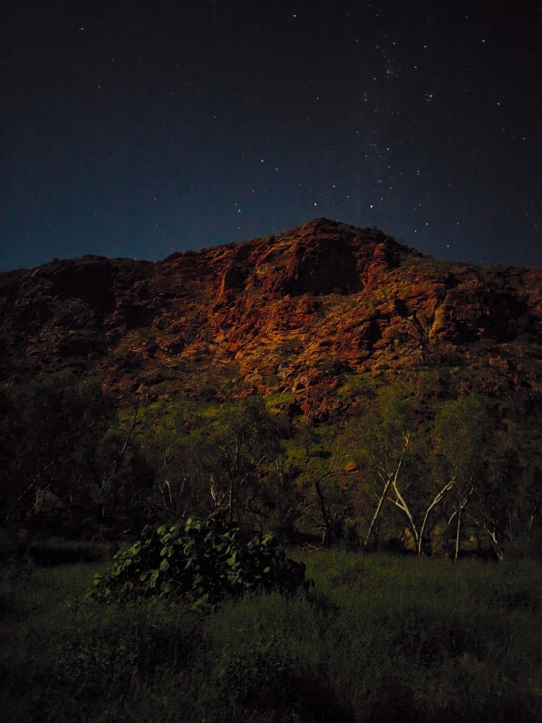
Perched at Tyler Pass Lookout, we set up camp with distant views of Tnorala, the remains of an ancient impact crater rising out of the landscape. We waited patiently for the magical hour of 7 p.m., when the relentless flies would finally retreat and the breeze would keep the mosquitoes at bay. Only then could we cook dinner in relative peace and enjoy good food and company beneath an unbelievably clear night sky scattered with stars. Just before bed, Chris was setting up the bedding when he froze and said, in the kind of voice that instantly raises everyone’s blood pressure, “Large spider. I need a paper towel NOW.” What followed was a tense late-night showdown with a truly enormous “meaty boy,” as he later dubbed it. It was easily the biggest spider he had ever seen and, at least in the moment, looked suspiciously like something that could send a person to the hospital—or straight onto an Australian wildlife documentary.
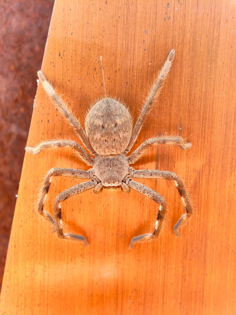
Our second night sleeping in the Wicked rigs proved to be another restless one. Winds from Cyclone Narelle far to the north swept through camp, rattling the rooftop tents loudly enough to make Chris seriously question just how much wind their frames were designed to withstand. A few nights later, Calder found a similar spider clinging to his tent, and we eventually learned they were huntsman spiders—not poisonous, but capable of delivering a painful bite. After that one was dispatched, a miner bird swooped in almost immediately and gobbled it up whole. Food, it seems, is not wasted in the Outback.
The drive into and out of Tnorala (Gosse Bluff) Conservation Reserve was easily our roughest and most entertaining stretch yet. At one point, we hit a crossing hard enough to send a full sheet of muddy water exploding over the hood and windshield, briefly turning the truck into a blind submarine. By then, every river crossing and mud hole had become a game, and we couldn’t stop laughing each time the trucks disappeared into another puddle and emerged a little less white and a lot more Outback-orange.
Once inside, we walked through the crater floor, looking up and around at the remaining ring from the impact. Tnorala is explained through both Aboriginal Dreaming and modern geology, two remarkably similar stories describing a dramatic event from the sky. In the Western Arrernte Dreaming, sky-women dancing in the Milky Way dropped a baby in a wooden turna (coolamon), which crashed to Earth and forced the rocks upward into the great circular ring seen today, while the morning and evening stars still search for the lost child.
Strikingly, the story closely mirrors the actual shape and violent formation of the crater, despite originating long before modern science, with the uplifted circular walls strongly resembling the aftermath of a massive impact. Geologists now believe that about 142 million years ago, a comet or meteorite slammed into Earth here, creating a huge crater whose eroded central uplift remains one of the world’s best-preserved impact structures.
One of the main reasons we rented a 4×4 truck was to tackle the Mereenie Loop/Red Centre Way. After happily handing over our AUS $5 permit fee, we set off on the 126-kilometer stretch of rough red dirt and rock road cutting through Aboriginal lands, linking the MacDonnell Ranges with Kings Canyon and Uluru. Nearly half of the Northern Territory is Aboriginal-owned land, and permits are required to enter many of these areas, adding to the sense that we were heading somewhere remote and special.
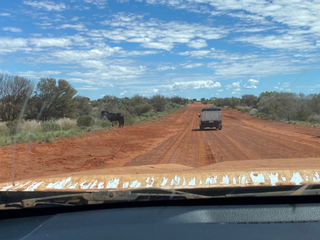
We were thoroughly warned beforehand: nowhere to stop, road conditions terrible after the flooding, deep washouts, rough corrugations—you know, the kind of warnings that only make something sound more fun. The drive absolutely delivered. We bounced, splashed, and rattled our way around lingering waterholes and potholes while wild horses and cows casually wandered across the road like they owned the place.
Somewhere between the flying mud, endless red dirt, and the feeling that our trucks might shake apart at any moment, it became one of the most surreal and ridiculously fun drives we’d ever done.
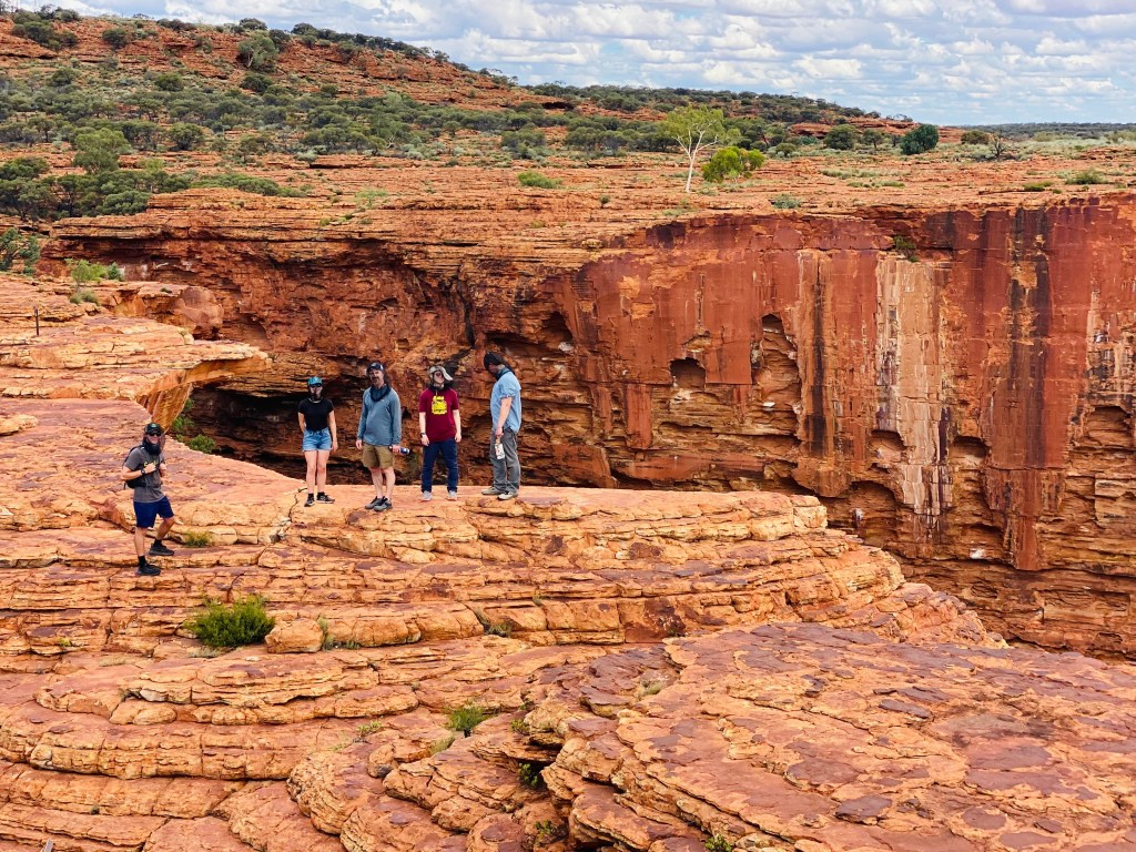
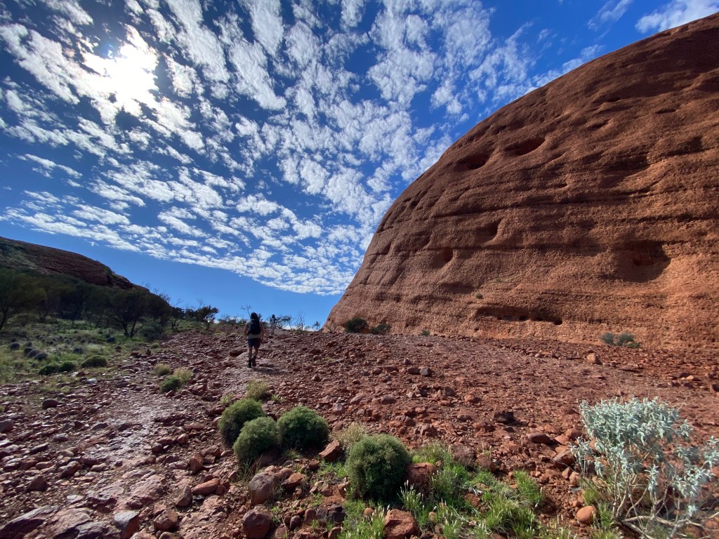
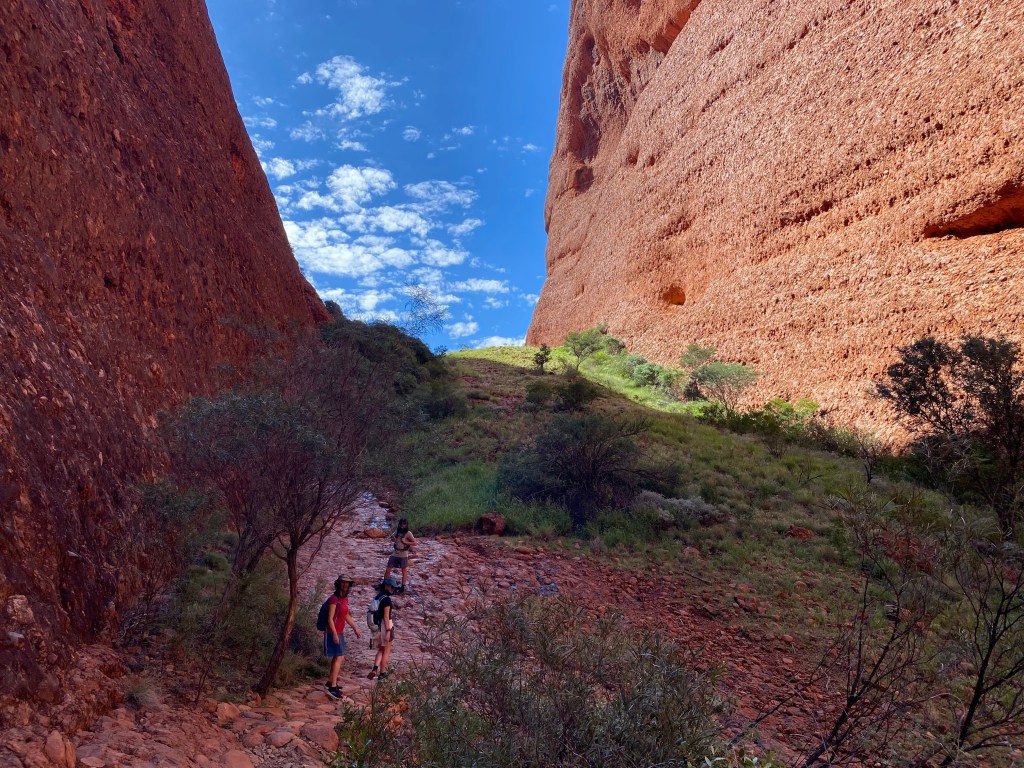
After our drive along the Mereenie Loop, we entered the Kings Canyon (Watarrka) region, a landscape carved over millions of years from layers of ancient sandstone. Its towering red cliffs and weathered domes were formed by erosion acting on sediments deposited more than 400 million years ago, back when this part of Australia was covered by inland seas and sprawling river systems. The Kings Canyon Rim Track, a 6-kilometer loop considered one of Australia’s great walks, was an absolute highlight.
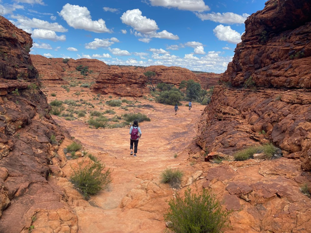
It began with a steep climb up stone steps before winding across dramatic sandstone formations and bridges, eventually descending into the beautiful Garden of Eden—an oasis of shade, birdsong, and lush greenery hidden within the canyon.
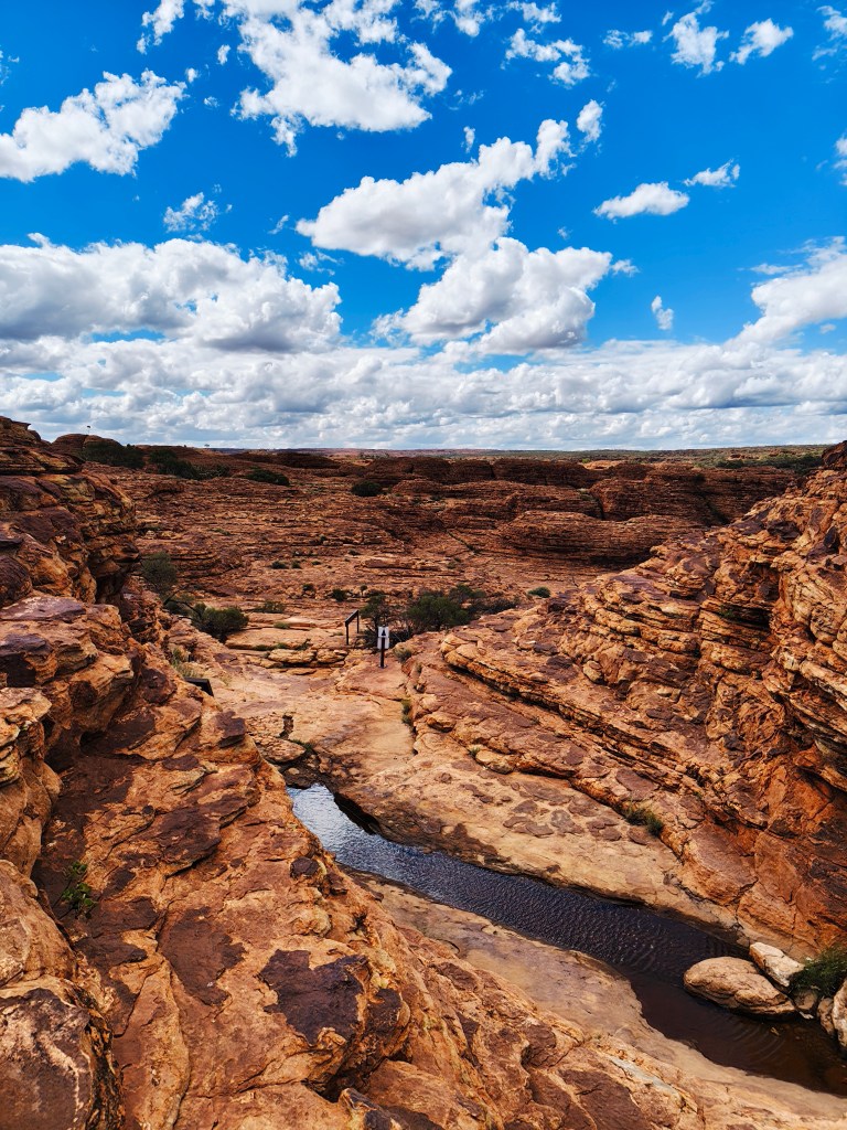
Towering canyon walls rose more than 100 meters above Kings Creek, surrounding a surreal landscape of beehive-shaped rock domes.
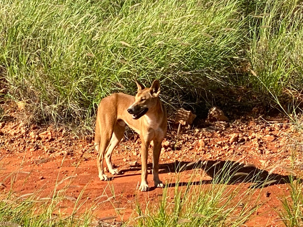
Back in the parking lot, a scrawny dingo wandered casually among the cars, looking equal parts wild predator and underfed pet.
We stayed overnight in the back corner of the Discovery Resorts campground, where we had a free stellar view of the art exhibit Light Towers at night, as well as the sunset over Watarrka. There was just enough wind overnight to noisily flap the tents and keep sleep questionable, and sometime during the night a dingo wandered through camp, startling Cora when she climbed down. By morning, I casually shook several large, still-living moths out of my cooking pot before boiling water for coffee, which apparently is now a normal part of Outback camping. I felt like an entomologist in the women’s bathroom, as I have never seen so many bugs—or such an astonishing variety of them—in one place, while hungry birds swooped in for breakfast around me as I brushed my teeth. At this point, I have been surrounded by more insects than in the rest of my life combined and am beginning to normalize it—though to be clear, I remain firmly anti-spider in my tent.
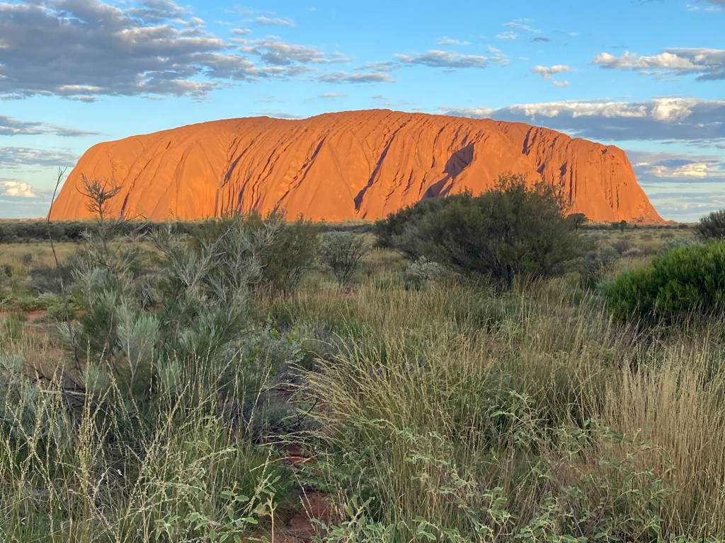
Then came the undisputed queen of the Red Centre: Uluru (formerly called Ayers Rock). The first glimpse of Uluru is unforgettable: a brilliantly red mass rising abruptly from the green desert grasses as though someone dropped a small mountain into the middle of nowhere.
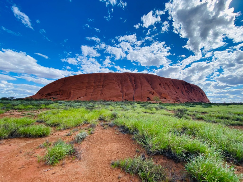
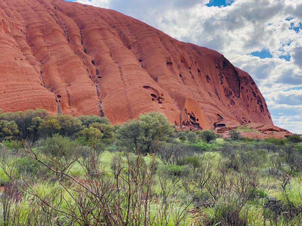
As we drove closer, I was stunned by the sheer size and smoothness of the monolith, especially the lack of major joints or fractures that would normally break apart a rock formation of this scale. Uluru is composed of arkose sandstone, a coarse-grained sedimentary rock rich in feldspar, and its iconic red color comes from the weathering of iron minerals by water and oxygen—essentially the geological equivalent of rust. Rising 348 meters above the desert floor with a circumference of 9.4 kilometers, it is the world’s most famous monolith, though astonishingly, nearly two-thirds of the massive weathered rock still lies buried beneath the surface.
This is Anangu land, and throughout our visit we slowly began piecing together the quilt of culture, history, and spirituality connected to Uluru. At the Cultural Centre, we learned about Tjukurpa, the Anangu system of law, spirituality, and creation stories that explains the origins of the landscape and guides relationships between people, animals, and Country. Far more than simply a rock, Uluru is a deeply sacred living cultural site woven with stories, ceremonies, and ancestral meaning. The Aboriginal Land Rights (Northern Territory) Act of 1976 and the establishment of the Central Land Council finally gave Anangu people a stronger voice in the management of their traditional lands. In 1984, the resort town of Yulara was opened 15 kilometers away, coinciding with the removal of tourist accommodation from within the park itself. Then, in 1985, ownership and management of the park were formally returned to the traditional owners through the Uluru-Kata Tjuta Aboriginal Land Trust in a landmark event now widely known as the “Handback.” In a remarkable act of cooperation, the Anangu elders signed a 99-year lease agreement within minutes, establishing a joint management arrangement with Parks Australia governed by a board holding an Anangu majority. Climbing Uluru itself was finally prohibited in 2019, reflecting a growing recognition and respect for the sacred significance of this extraordinary monolith.
As we walked the 10.6-kilometer circumference of Uluru, there were areas where visitors were respectfully asked not to take photographs. We learned that certain formations are meant to be experienced only in the moment, as part of Tjukurpa, rather than captured and viewed later. Every marking, fold, cave, and view of Uluru and Kata Tjuta carries spiritual meaning for the Anangu people, with some sites holding a sacred significance comparable to churches or holy scripture in Western traditions.
We found our campground in Yulara after dark and set up what would become our home base for the next four nights, giving us time to fully experience this extraordinary place. Because we arrived a bit early in the tourist season, we often found ourselves with unusually quiet moments at culturally significant sites like the Mutitjulu Waterhole and the Mala Walk to Kantju Gorge, where we enthusiastically cheered on giant tadpoles racing to become frogs before the desert dried again.
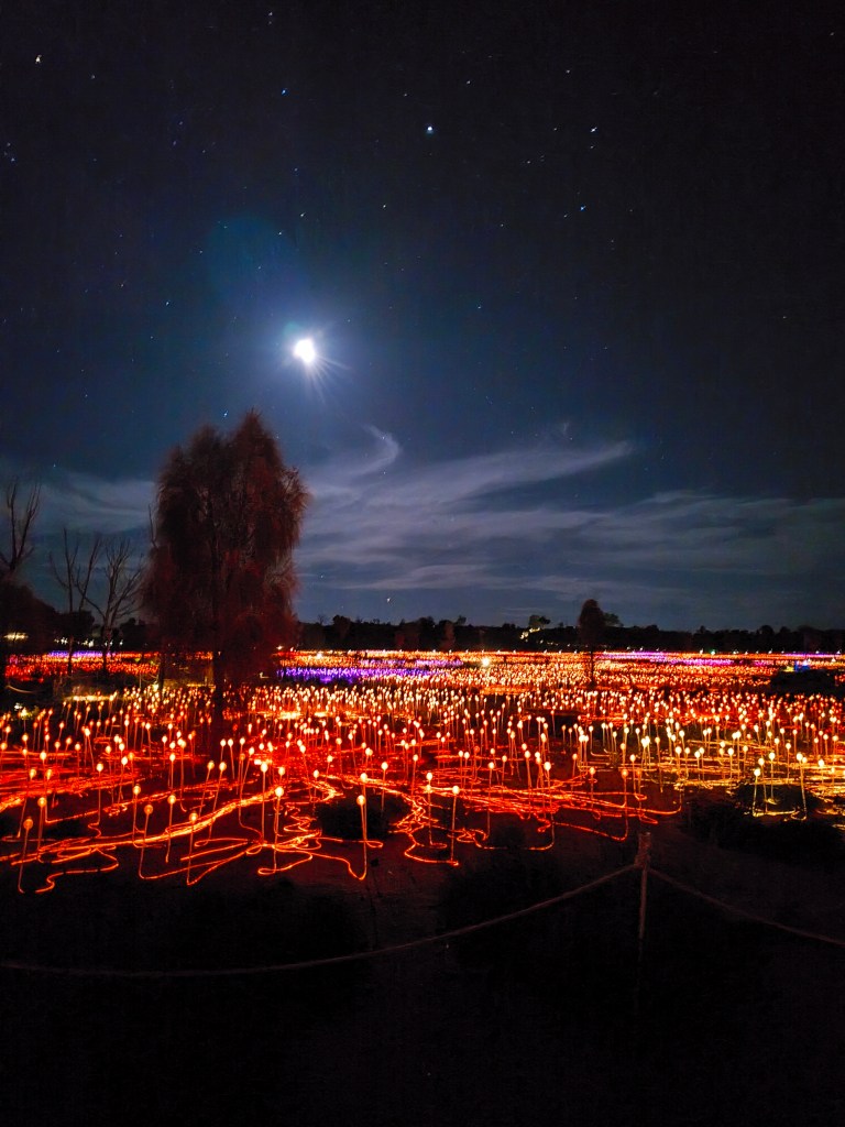
One evening, we wandered through Field of Light, Bruce Munro’s massive 2016 art installation covering roughly 50,000 square meters with more than 50,000 glowing glass spheres spread across the desert.
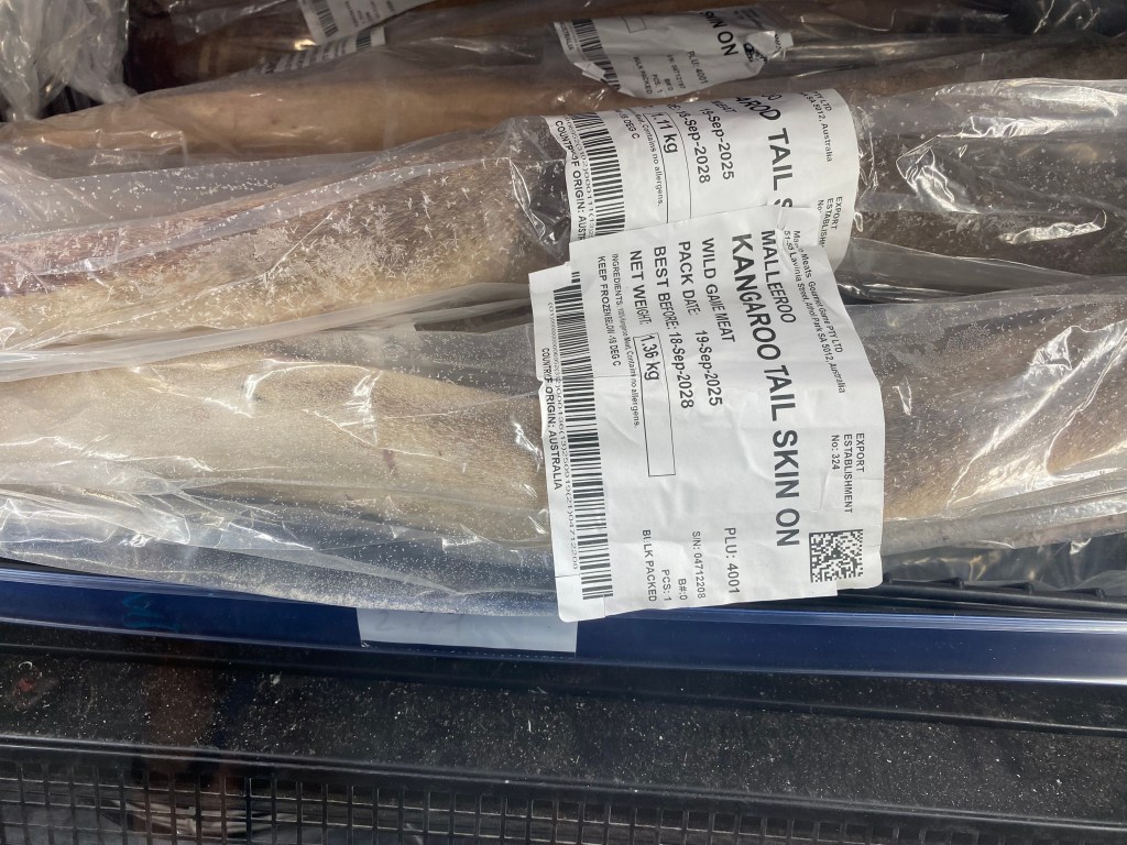
Another night, we shared the Sounds of Silence Dinner with three retired Australian schoolteachers and their husbands, enjoying a four-hour feast atop a dune overlooking both Uluru and Kata Tjuta. The kangaroo steak was excellent.
Chris came away inspired after attending a didgeridoo workshop to procure and start playing again. I felt inspired after attending talks on traditional bush tucker and tools. Much to my family’s relief—but my disappointment—we still have not managed to procure any witchetty grubs, honey ants, or bush coconuts, though we have at least succeeded in eating kangaroo and wallaby whenever we can find it.
Walkatjara Art immediately gave us good vibes when we stepped inside, feeling warm, welcoming, and deeply connected to community. Uniquely community-owned, it provides a safe and comfortable place where artist women from nearby Mutitjulu are picked up to gather, visit, and paint, with 50% of art sales going directly to the artists while the remaining proceeds help cover supplies and support the center. The first time we visited, the women artists had just left and there, on the ground, was a still-drying painting depicting the three main rocks here (Uluru, Kata Tjuta, and Atilia), surrounded by the brush symbol indicating bush medicine. I was immediately taken by it. We returned the next day while the artists were working and were able to tell the artist directly “Palya” (thank you) for the beautiful artwork that would hang in our boat and then back home in Alaska. The women loved hearing about our boat explorations, baffled about such an existence. From ocean life, we met these amazing artists in their local desert studio.
Australia is home to some of the oldest continuous cultures on Earth, with Aboriginal peoples living here for more than 60,000 years before Europeans arrived. For generations, Australian history was often told as a story of “settlement” rather than invasion, overlooking the frontier wars, massacres, forced removals, missions, and policies aimed at erasing Indigenous identity, including the “Stolen Generations” of children taken from their families—later exposed in the 1997 Bringing Them Home report that led to National Sorry Day. In 1788, an estimated 750,000 to 1.2 million Indigenous people speaking around 440 languages lived across the continent. Today, more than 500 native title claims have formally recognized Aboriginal and Torres Strait Islander rights across about 40% of Australia’s landmass, and Indigenous culture is now a central part of Australia’s identity, though Indigenous Australians still are not formally recognized in the country’s constitution.
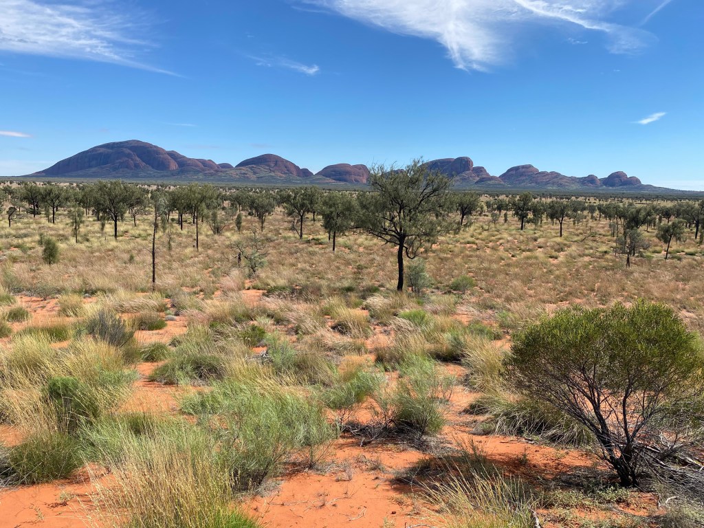
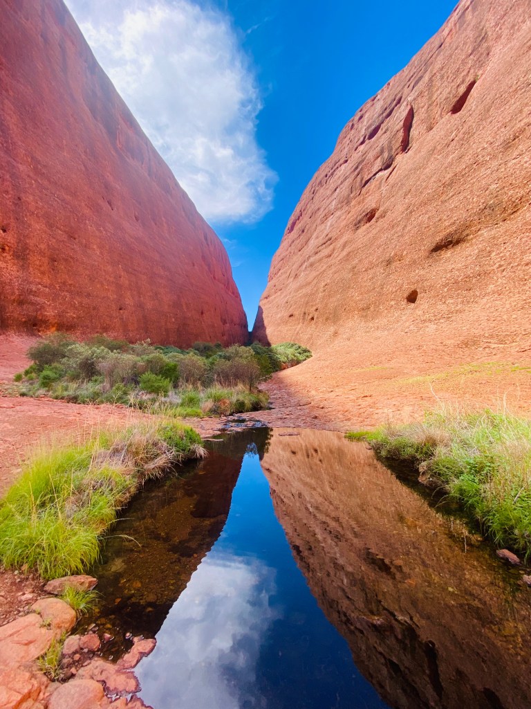
We also explored Kata Tjuta (formerly known as the Olgas), a striking group of 36 massive domes, with the tallest rising 546 meters above the surrounding desert plain. Kata Tjuta means “many heads” and is a sacred men’s site for the Anangu people. Unlike Uluru’s sandstone, the domes are made of conglomerate rock—a rugged mix of gravel, pebbles, and boulders cemented together over millions of years by sand and mud. We hiked the spectacular Valley of the Winds track (7.4 km), thankfully squeezing in just before temperatures climbed high enough for the trail to close at 36°C, and also wandered through Walpa (“windy”) Gorge, a sheltered refuge for desert plants and animals.
Under Aboriginal law, only certain aspects of the Dreaming can be shared with non-initiated people, and there is an intentional secrecy surrounding much of Tjukurpa. This was beautifully explained in the book I Am Uluru: A Family’s Story: “With Tjukurpa, there’s so much that just can’t be told to the outside world… you want people to understand our culture and value its preservation, but you don’t want to destroy what’s sacred by not observing the sacredness of that knowledge.” I found the book captivating to read between walks out on Country, helping me slowly piece together small glimpses of the language, spirituality, and culture of the world’s oldest continuing Indigenous society. It was a gift to linger in this area, a place of intense palpable spirituality.
After getting a bit artistic painting wooden Australian ornaments with dot patterns and designs, we grabbed a few groceries, filled up our rig, and hit the road again. At Kings Creek Station, we topped off fuel at about $4 AUD per litre (around $10.65 USD per gallon) and heard how that very day they had 12 cancellations due to a mix of factors including conflict in Iran, fuel prices, and broader travel insecurity—another reminder of how decisions made in the U.S. and elsewhere ripple all the way into the most remote corners of Central Australia. We stopped for lunch and couldn’t resist trying one of their camel burgers, which turned out to be delicious. Australia is home to the world’s largest wild camel population, descended from animals brought in during the 1800s for desert transport and exploration. At checkout, we tried to buy a six-pack of beer but learned the area is effectively “dry,” meaning alcohol can only be purchased by staying guests. In Alice Springs, new rules also restrict alcohol sales to after 3 p.m., and in some remote towns you need proof of local accommodation just to buy it.
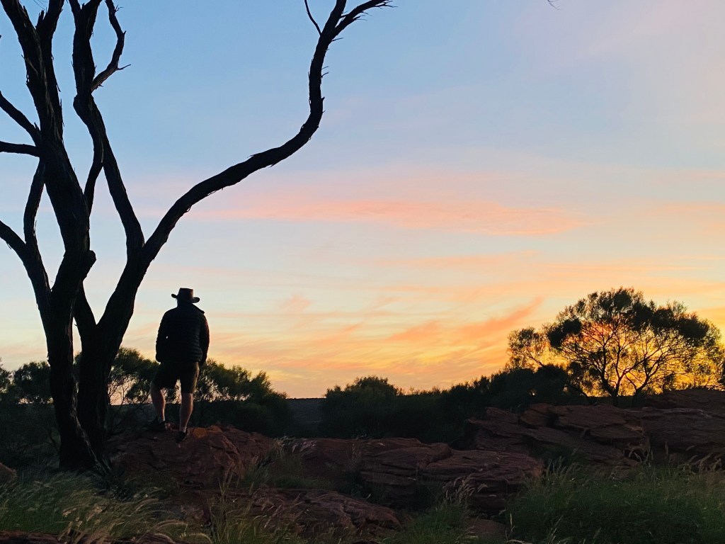
We stretched our legs at Kathleen Springs near Kings Canyon, then at the base of Kings Canyon before settling into a free roadside campsite perched along a cliff. This part of remote Australia has a great system of 24-hour roadside camps, letting you pause for one night. We watched sunset over Kings Canyon bundled in coats as temperatures dropped and wind picked up, then woke to a 6:30 a.m. sunrise from our rooftop tent, coffee in hand, as a pair of dingoes trotted straight through camp like they owned the place.
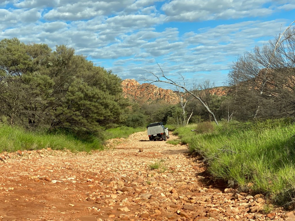
We set off on the Mereenie Road again—because why drive it once when you can happily bounce along it twice? Heading back the same way we came from Alice Springs, we wanted to take in the stunning scenery again and pick up a few hikes we’d rushed past on the way through. It was also interesting to see what the recent floods had left behind on the road. This time the Mereenie Loop was drier in places, but rougher too, with long stretches of washboard corrugations and the occasional wet patch still hanging on. Curious cows wandered across in front of us, a pack of donkeys stared us down like we were the entertainment, and wild horses grazed casually at the roadside. We made a detour into Roma Gorge—a high-clearance 4WD “road” that quickly turned into a rocky riverbed—where we stopped for lunch, swatting flies between bites, before eventually turning back.
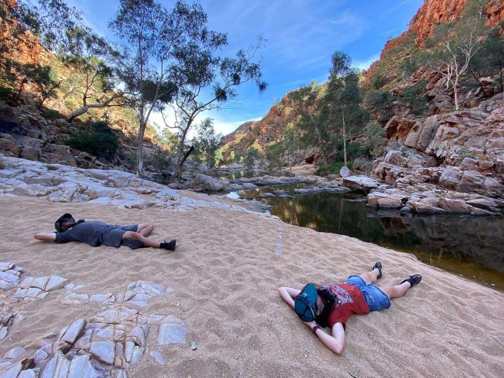
That night we camped at Redbank Gorge, perched with views over the MacDonnell Ranges. We hiked into the gorge itself, the track largely washed away by recent floods, and settled into the sand to watch rock wallabies hopping up near-vertical walls. In the soft evening light and perfect temperature, we drew patterns in the sand and simply let the stillness of the place settle over us.
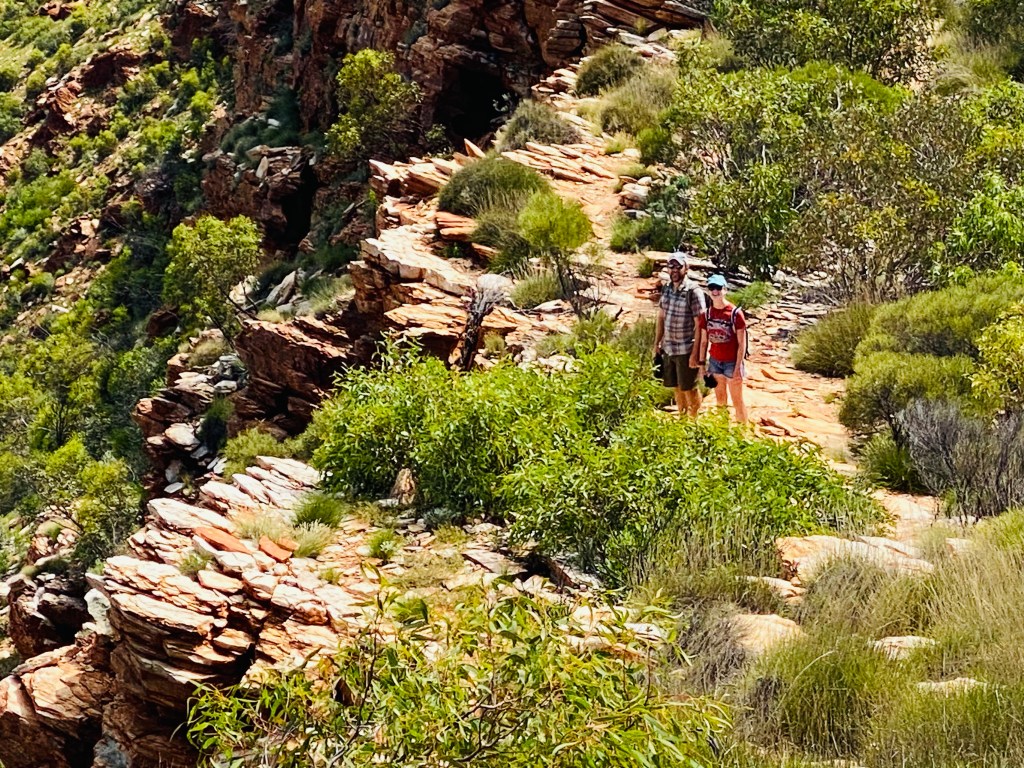
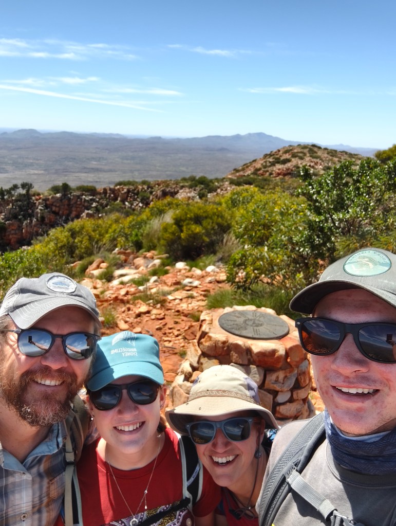
Throughout our time in the East MacDonnell Ranges, I had been fascinated by the Larapinta Trail—a 223 km thru-hike winding through the region, broken into sections that can be tackled individually or as a whole journey. We decided to take on Section 12, the final stretch, which leads to the summit of Mount Sonder (Rutjupma/Rwetyepme), the fourth-highest peak in the Northern Territory at 1,380 metres. The mountain itself is made of ancient quartzite, formed around 850 million years ago, later uplifted, folded, and slowly eroded into the rugged peak we climbed across. The hike took us around five hours as the day warmed up, with flies intensifying as we essentially became a moving salt lick for them.
Along the way, we noticed vividly patterned grasshoppers carrying smaller ones on their backs—only later realizing it wasn’t adorable parenting, but mating behavior. At the summit, tired and slightly sun-soaked, we enjoyed juicy pears while taking in a sweeping bird’s-eye view of the surrounding ranges, where the folded geology revealed itself in striking patterns across the landscape.
We stopped briefly at Ormiston Gorge, where Chris happily soaked his sore feet in the cool water, before continuing on to Standley Chasm (Angkerle Atwatye) Campground for the night. This 100% Arrernte-owned and operated site had only just reopened after being heavily impacted by the recent floods, with clear signs of the water’s force still visible as we walked into the chasm in the middle of the day. The chasm itself is only about three meters wide but rises roughly 80 meters high, with a rare north–south orientation that allows sunlight to penetrate directly in for only around 90 minutes at midday, setting the quartzite walls glowing in vivid reds and oranges. Lined with ancient cycads and holding one of only eight permanent waterholes in the West MacDonnell bioregion, it felt like an especially intimate and powerful place, and is also a sacred women’s dreaming site where Western Arrernte women traditionally gave birth in its shelter.
The Alice Springs Desert Park is an excellent introduction to the different desert ecosystems, and we especially enjoyed the up-close bird show and discovering nocturnal wildlife like the thorny devil in the nocturnal house. We then stopped for pizza and a microbrew at Alice Springs Brewing Co.—a bit of a mirage in the middle of the desert—before heading out into the “East Macs” for the night.
Trephina Gorge Panorama Campground may have been our favorite yet, as we camped completely alone beside a glowing sunset over the gorge walls and watched the stars emerge in total stillness.
The night was only broken by owls calling “morepork” into the darkness, a familiar sound for NZ ears, and it felt like Australia is truly made for this kind of remote camping.
Before leaving, we walked the Trephina Gorge Loop along sheer quartzite ridges before descending to the river red gum-lined gorge floor to wade in the water, gaining a deeper appreciation for how these permanent waterholes shape survival in the desert. We also visited the largest ghost gum in Australia—33 metres tall and over 300 years old—alongside the remarkable river red gums whose massive underground root systems mirror their towering presence above ground.
Our next stops included Corroboree Rock Conservation Reserve, a striking 800-million-year-old remnant of ancient rock strata and an important site in the Eastern Arrernte Perentie Dreaming. It felt fitting that, almost on cue, a large perentie—the biggest lizard in Australia with distinctive dark-edged yellow spots—crossed the road in front of us. We also paused briefly at Jessie Gap (Akapulye) and Emily Gap (Athuwerrke), wandering through the gorges and viewing the rock art sites connected to the Caterpillar Dreaming of the Central Arrernte people.
We rolled into Alice Springs Discovery Park to recombobulate and reset. We were meant to head to Queensland tomorrow, with plans originally set for the Far North and the Daintree Rainforest, but—as always in travel—those plans have shifted. Record flooding has hit the region, even washing a car ferry downstream when it broke free, and as if that wasn’t enough, a tropical cyclone has since moved through.
After returning our Wicked rig, we took a cab to the airport where people were excited by a snake loose near our gate. The kids, straight out of snakeless Alaska, looked over and thoughtfully asked, “Hmm… could that be a legless lizard?” Sure enough, when the official snake guy arrived (as casually as if this happens between boarding calls), he picked it up in his hand, announced, “It’s just a legless lizard,” and released it back outside like it was no big deal. At that point we decided we’d officially graduated the Outback school of wildlife identification. Next stop: Far North Queensland, where the rainforest is expected to come with even more opportunities for surprise biology lessons.

One response to “Australia Part 4: Wicked Outback Adventure”
Hello to the Terikah Crew!Wh
LikeLike