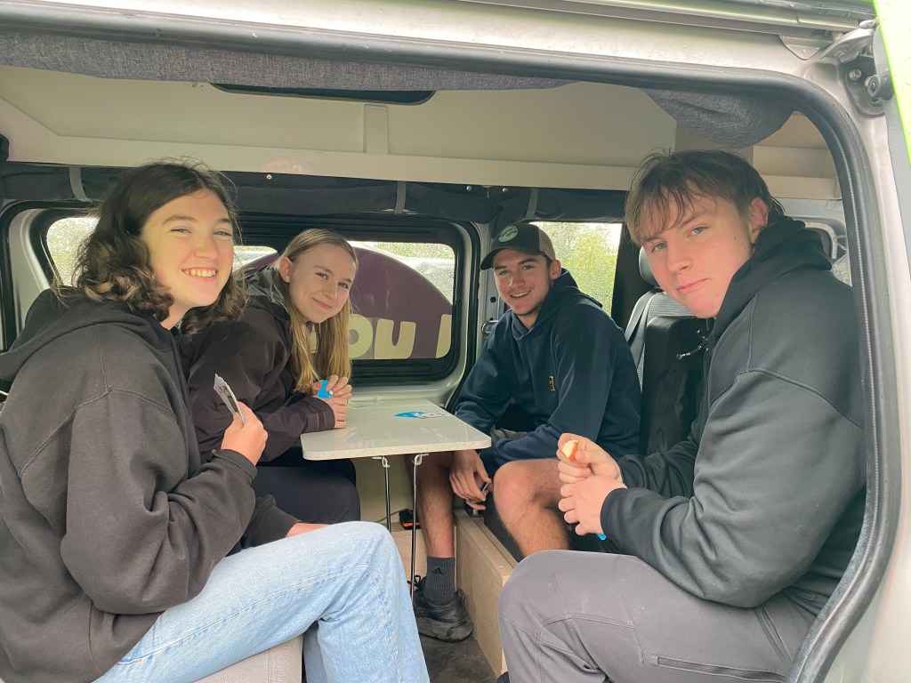
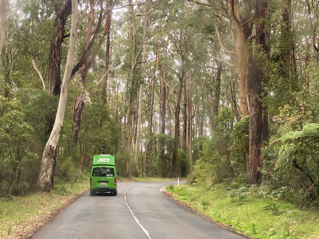
We are quite excited to be sharing the camping portion of this Australian adventure with the Whitacre family, our Alaskan neighbors, as we drive two “Jucy” campervans from Melbourne to Adelaide, including the Great Ocean Road. There is nothing subtle about two brilliant green Jucy vans, each packed with four of us juggling and shuffling our endless pile of stuff, as we bump down the road. This is Gabriele Whitacre’s senior year trip and her brother Elijah, who is in college, joined up too. When we park, we can always spot our Jucies with the big motto on the side, “Find Your Happy!”

After bakery emu rolls and kangaroo pies in Torquay, we took a walk on the beach where the kids created a sand barrier to “stop the tide,” which they have been doing since they were kids playing on our local beaches together. Next, it was time to check one off the Whitacre kids’ life lists – skydiving! Watching them and hearing their experience after was a definite highlight. The Hyer crew is still a bit shy of adrenaline rushes after our jetboat accident from last year, but Calder and Jen both agree they will skydive…just some other day.
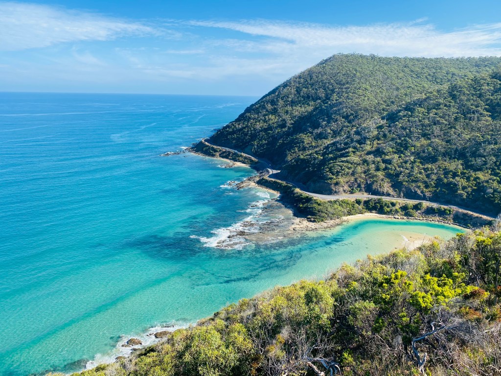
Then off to start our drive on the Great Ocean Road! The Great Ocean Road stretches about 243 kilometres along Victoria’s rugged south-eastern coast, built largely by hand between 1919-1932 by returned World War I soldiers, carving a scenic route through cliffs, beaches, and rainforests. We meandered along, stopping at the official memorial gateway, the Split Point Lighthouse, and Teddy’s Lookout.
That night, at the Jamieson Creek Campground, we hung out with locals around the grill and later at their campfire. We had a sweet, shy wallaby in our camp.
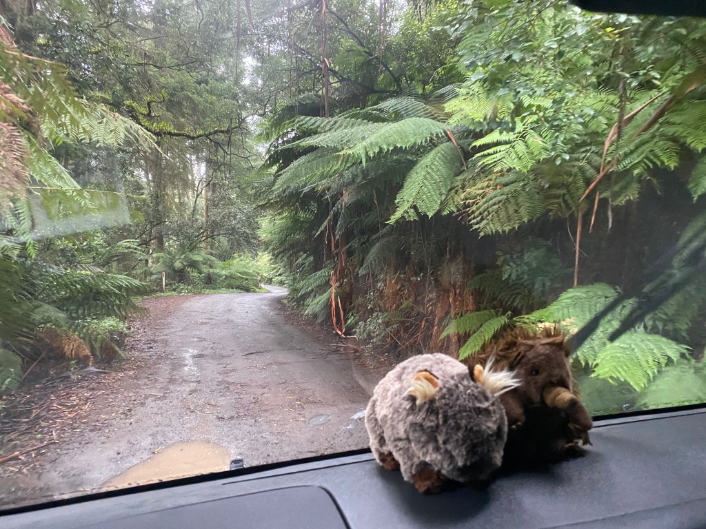
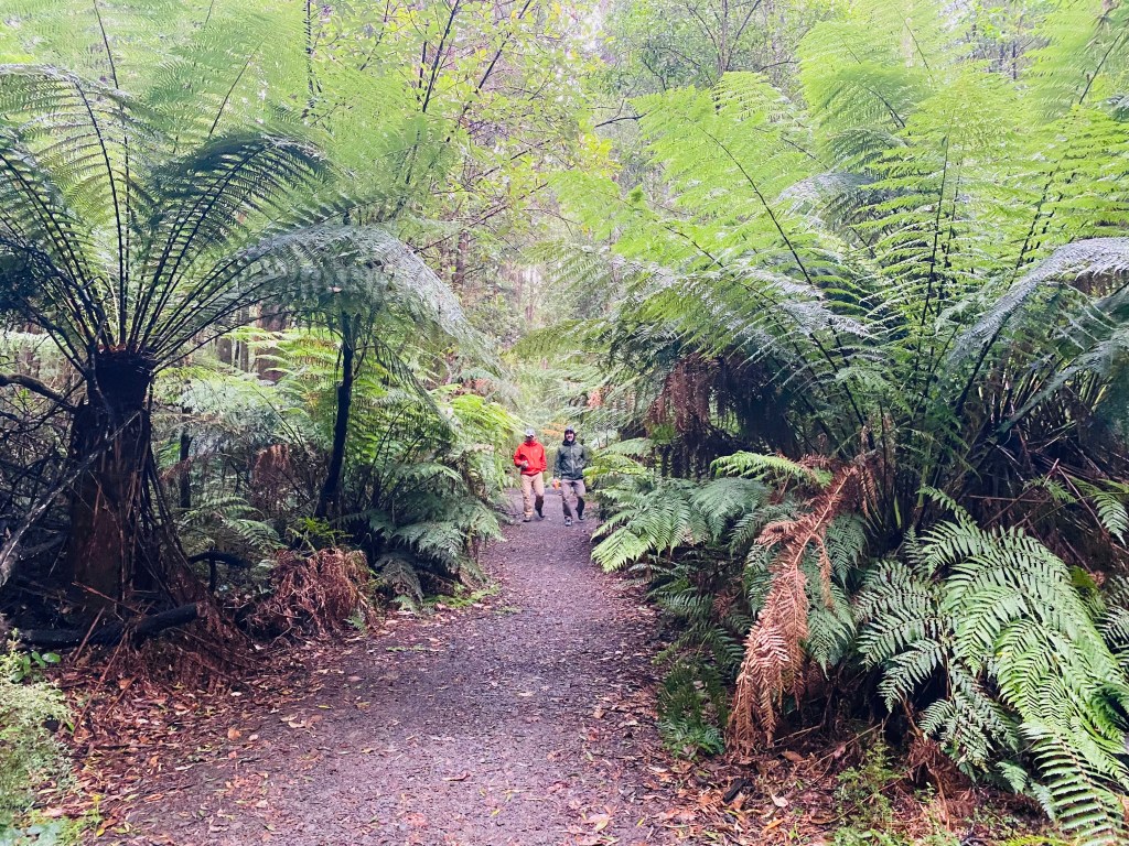
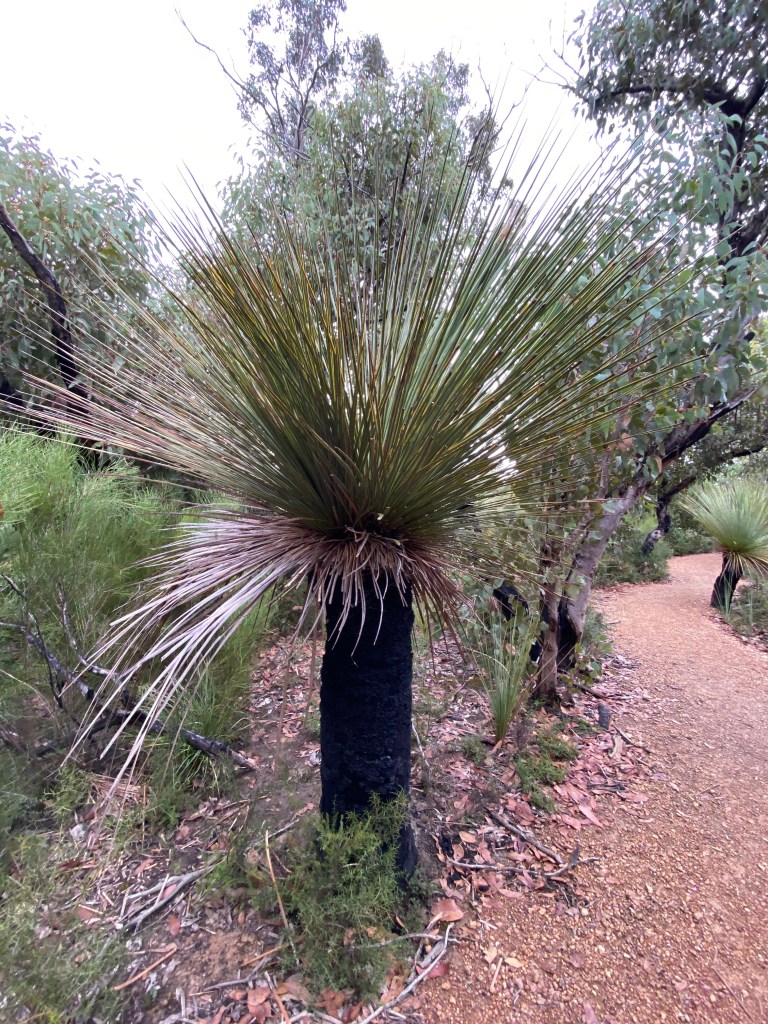
The next day, we left the coast for the Otways, a unique rainforest environment…with the rain to go along with it! The Otways are a temperate rainforest oasis along the rugged, otherwise drier coastline – a true microclimate with 50-80 inches of annual rainfall, cooler temperatures, lush fern gullies, towering eucalyptus, and dense rainforest pockets that make it one of Victoria’s greenest and most biodiverse regions.
As we drove along Grey River Road (aka the Kennett River Koala Trail), we spotted our first two koalas chilling high up in the trees. So exciting to see these koalas in person! We got out of the car and meandered by foot up a side trail and found ourselves face to face with a munching koala, as he was in the lowest branch of a tree at our eye level.
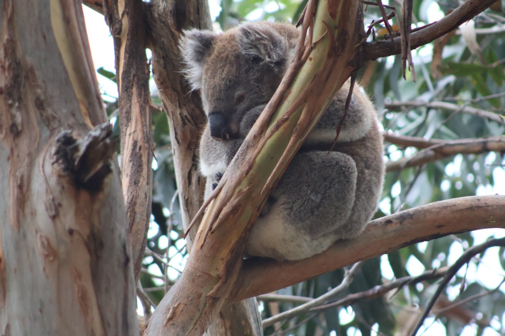
We spent quite a bit of time watching him, as he watched us. The koala is a tree-dwelling marsupial that feeds almost exclusively on eucalyptus leaves and spends most of its life in the canopy. Its populations are increasingly threatened by habitat loss, bushfires, disease (especially chlamydia), and climate change.
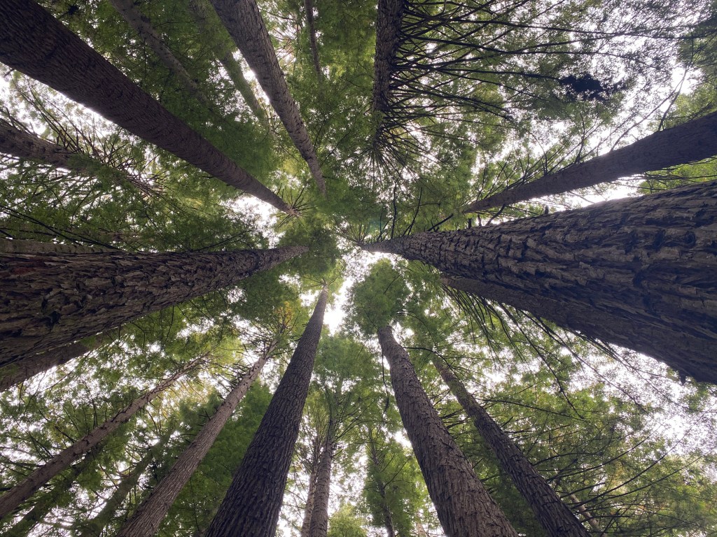
Driving to our campsite, we stopped at the Redwood Forest Otways, an unexpected and serene grove of towering Californian redwoods planted in the 1930s, now rising dramatically above the forest floor in a quiet, cathedral-like setting.
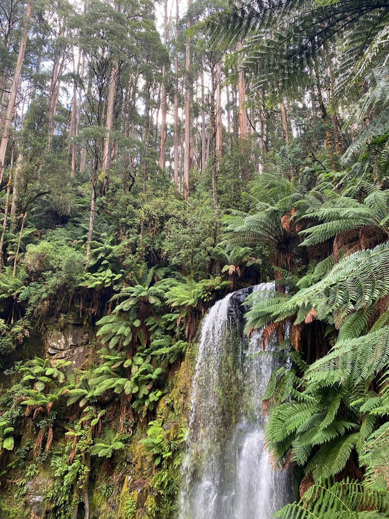
By the time we got to our Beauchamp Falls camp, the wind and rain set in and we huddled in our Jucies for a couple of hours before an evening post-rain walk to the falls.
The next day, we wound our way out of the forest, stopping for a walk at Hopetoun Falls where we had a chance to ask a local forest ranger all our pressing questions. At our next stop, Maits Rest Rainforest Walk, we spotted the Otway black snail, an endangered, glossy black terrestrial snail endemic to the Otway Ranges, which we helped cross the trail to a safe bed of damp leaf litter.
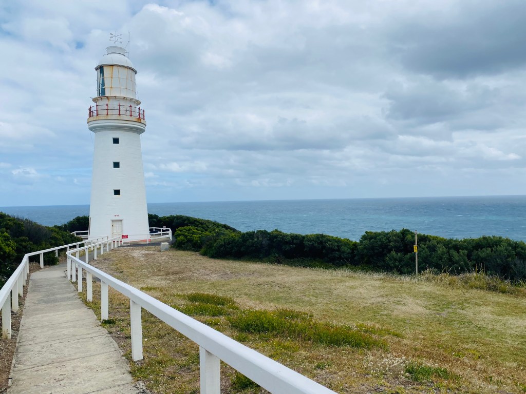
The Cape Otway Lightstation, built in 1848, is Australia’s oldest surviving lighthouse on the mainland, perched on a dramatic cliff overlooking the treacherous Southern Ocean. Its towering white structure guided countless ships safely along the rugged coast, and today it remains a historic landmark with museum displays and panoramic ocean views. As we wandered through the area, I was struck by the image of it as a “Beacon of Hope.” After 3 to 5 months at sea without sight of land on the harsh Great Circle sailing route that put them in the Southern Ocean, the lighthouse was a symbol of survival and arrival for many of those coming from Europe.
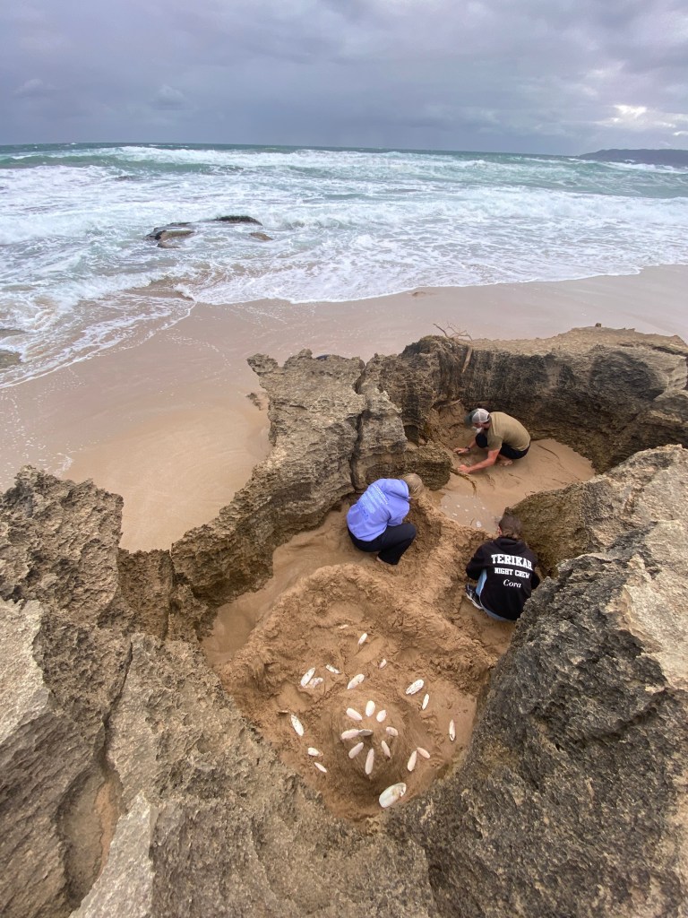
At windy Johanna Beach, where we camped next, we watched the massive waves roll in, the kids reliving their childhood days of again trying to “stop the tide,” as they built a blockage for the tide to protect the Fortress of King Cuddle (a cuddlefish bone on a high sand tower). They succeeded initially, but sadly found King Cuddle’s fortress destroyed by morning.
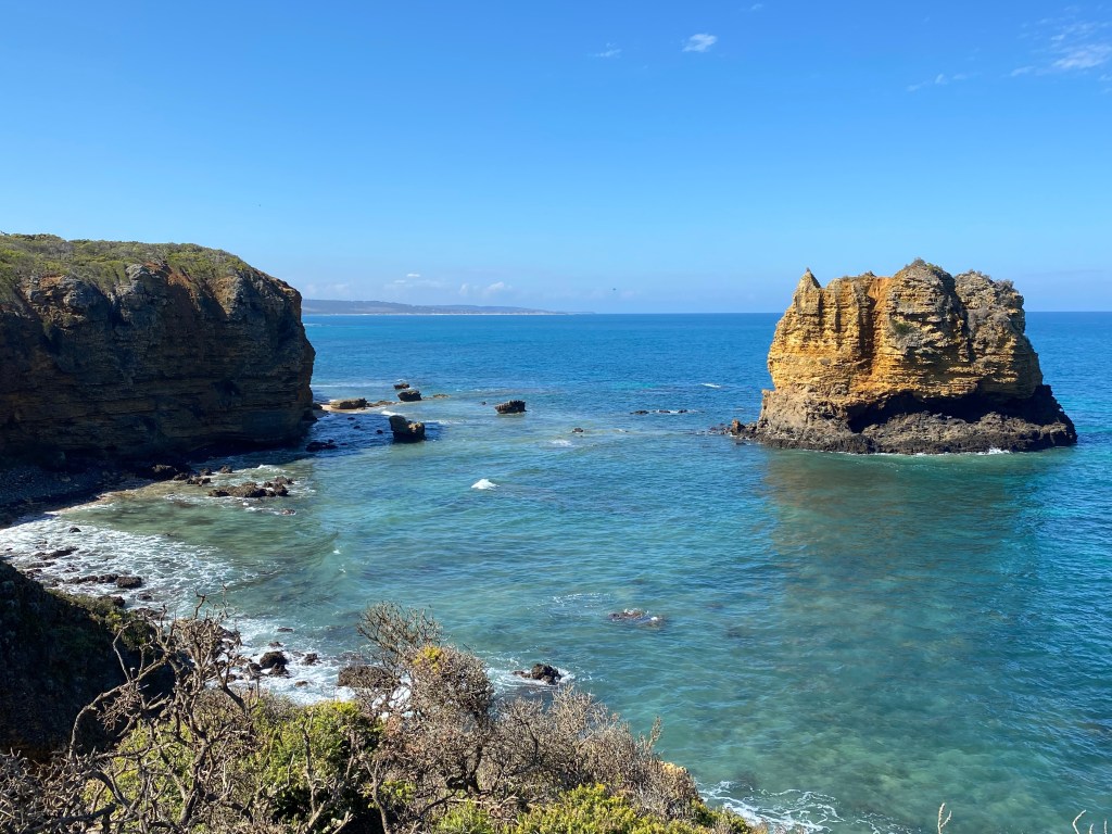
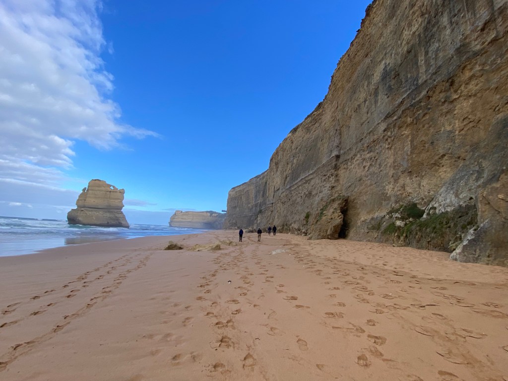
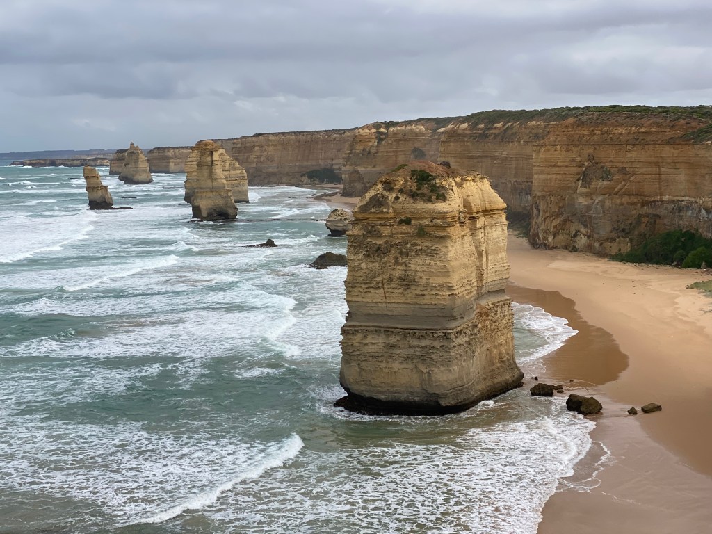
The “grand finale” of the Great Ocean Road was the region around the Twelve Apostles. The Twelve Apostles are towering limestone stacks formed 10–20 million years ago as the ocean gradually wore away softer rock along the cliffs of the Great Ocean Road, leaving the harder limestone pillars standing dramatically offshore. We descended the 86 Gibson Steps to stand on the sand beneath 70-metre cliffs and gaze up at the first of the Twelve Apostles.
We wandered around the Loch Ard Gorge, a dramatic coastal inlet framed by towering limestone cliffs, named after the 1878 shipwreck of the Loch Ard. We looked out at the dramatic points of the Razorback Lookout, into the Thunder Cave blowhole, and walked down to the beach.
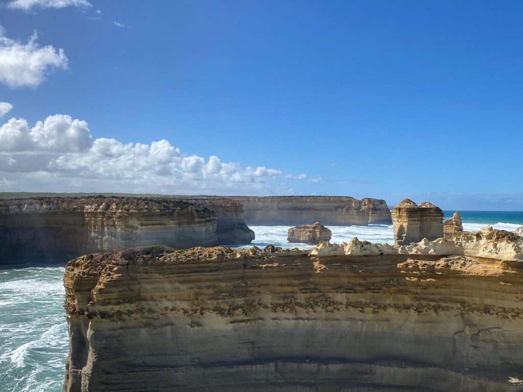
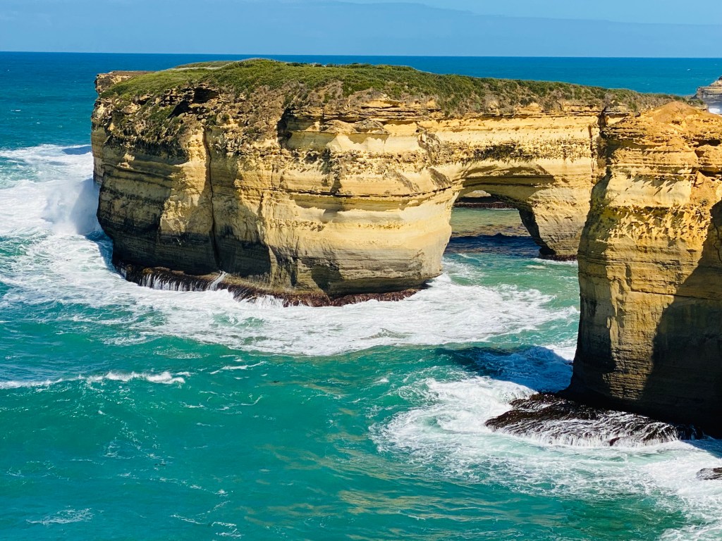
Our last stop along the Great Ocean Road was London Arch. It was a full day of stunning rock formations and cliffs. We officially drove the entire Great Ocean Road in our Jucies!
Traveling in the Jucy is fairly hilarious at times, watching these bright green vans along the windy roads together and parked next to each other camping. Things will fall mid-trip (who forgot to shut that cabinet?) and Marina keeps a rock perched on the stove to keep it lit while cooking. The shuffle of items every night and every morning is mostly entertaining, but we are sleeping great overall in our cozy van.
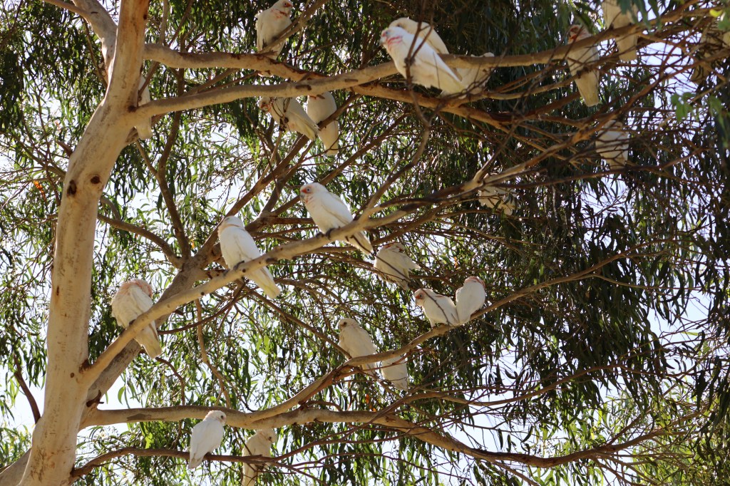
Next stop – An ancient volcanic crater filled with wetlands and bushland, Tower Hill Wildlife Reserve, is one of the best places in Victoria to see wildlife up close. Tower Hill also holds deep Aboriginal cultural significance; interpretive signage explained its geology and Gunditjmara heritage as we walked the Lava Tongue Boardwalk among the wetlands, and up a short, steep track to a lookout over the crater’s lakes. Kangaroos at the top and koalas cozy in the trees at the bottom. At the Koroit-Tower Hill Caravan Park, very loud flocks of parakeets landed in the trees around us and curious possums approached us at night.
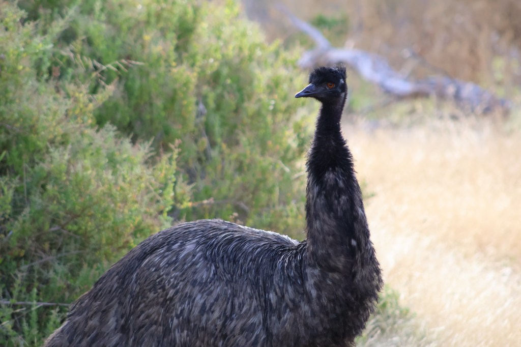
Before leaving the area, I requested we do a quick drive through Tower Hill again to look for an emu. Immediately upon driving into the Reserve, standing regally in full view, was an emu. Cue the emu!
We were also treated to an extremely active koala moving through the eucalyptus treetops.

Onto the Limestone Coast, a geologically unique region dotted with dramatic sinkholes, caves, and underground aquifers formed by the gradual dissolution of ancient limestone. Staying at Pine Country Caravan Park in Mt Gambier, we walked the perimeter of Blue Lake which is incredibly… well… blue.

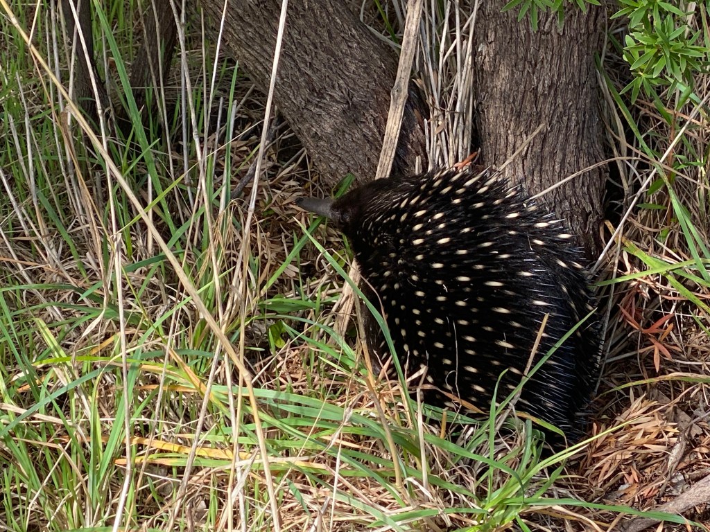
The striking color is caused by a seasonal interaction of sunlight, temperature, and water chemistry. Each summer, increased sunlight and warming trigger calcium carbonate crystals to form, which scatter shorter blue wavelengths of light, turning the lake a vivid cobalt blue before it fades back to a darker gray in winter. Walking along, we watched an echidna, quite close to us on the trail.
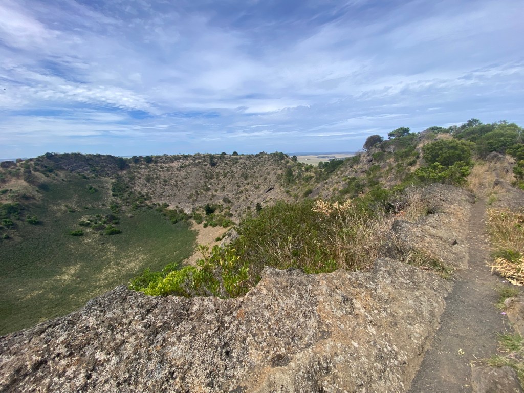
We hiked up an extinct volcano, the Mt Shank Crater Rim Walk.
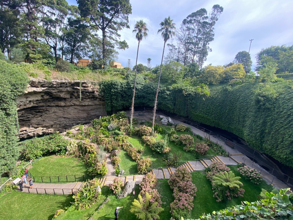
We hiked down a beautifully landscaped sunken garden at the Umpherston Sinkhole, a former limestone cave that collapsed.
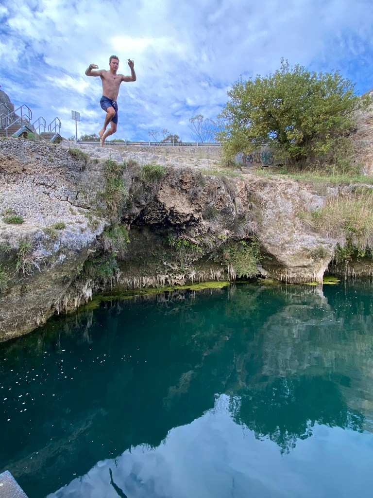
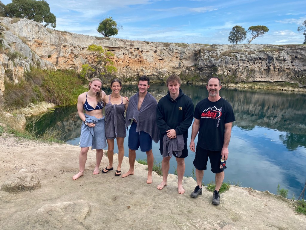
Finally, we took a dip in the Little Blue Lake, another sinkhole that seemed to appear out of nowhere, amidst farming land; it was a brisk and refreshing way to start the morning.
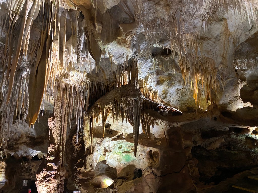
The drive from Mt Gambier to Cape Jervis was a long 560 km in the Jucy vans. We stopped for a cave tour at Tantanoola Cave Conservation Park, a small but beautifully decorated limestone cave, with colourful and delicate stalactites and stalagmites, including a tall column nicknamed the “chocolate fountain” because of its rich brown, glossy appearance under lighting.
Stopped a bit later for a lunch and short walk on the Long Beach at Robe, another example of Australia’s naming of places as they are. It was indeed, a very long beach. It was the first time that we saw the Southern Ocean on our maps (no longer in the Pacific Ocean) and dipped our toes in this cold water before moving on. It was odd entering Cape Jervis Caravan Park in the dark with a blurry map left out in the office for late arrivals, multiple farm buildings, and unclear sites. We temporarily set up next to a sewage vent, unbeknownst to us, but the odors prompted us to move to the cow pasture which was a relative improvement in olfactory experience. My shower came with a large complementary funnel spider, that I kept a very close eye on, while lathering up.
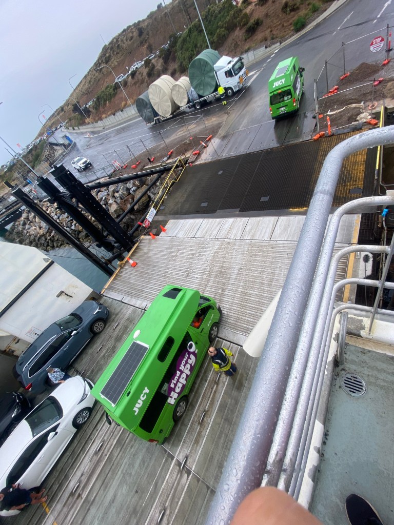
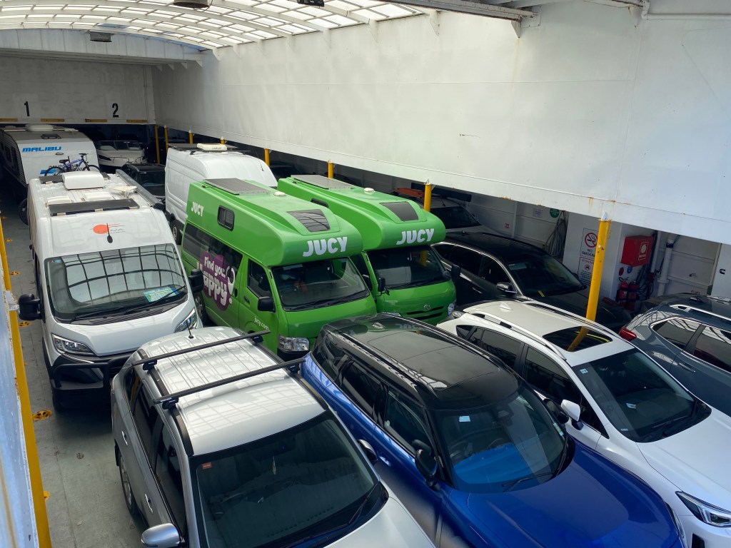
The next morning, we took the 45-minute ferry ride from Cape Jervis to Kangaroo Island, Australia’s third-largest island (about 4,400 square km) with its small population of roughly 5,000 people, known for its rugged coastline, native wildlife including kangaroos and sea lions, and large protected areas that preserve much of its wild, natural character. Chris and Heath did a stellar job backing up the Jucy vans onboard.
We had been notified a month ago that our ferry tickets had been changed to an hour later and they thanked us by giving us free beverages on board for this “inconvenience” of an extra hour of sleep. On land, we donned stylish hairnets at Ligurian Bee Centre for a tour and tasting, learning that Kangaroo Island is home to the world’s only pure population of Ligurian bees, introduced in the 1800s and kept in strict biosecurity isolation to preserve their genetics. We left with honey ice cream and mead in hand before stopping for a microbrew tasting and pizza at Kangaroo Island Brewery, where their dog Moose quickly joined our table as a guest.
As we drove, the evidence of fire was all around. During the 2019–2020 Australian bushfires, known as the Black Summer bushfires, nearly half of Kangaroo Island was burned, devastating vast areas of habitat, farmland, and wildlife. Thousands of animals—including koalas, kangaroos, and other unique endemic species—were killed or displaced, with long-term impacts on the island’s ecosystems and recovery still ongoing all around us. Flinders Chase National Park covers the rugged western end of Kangaroo Island and was heavily impacted by these fires; the park is now a powerful landscape of regeneration, where native vegetation and animals are steadily recovering. As we walked the Platypus Waterholes Walk, with a few jump scares from wallabies and kangaroos, we learned about the necessity of fire in this landscape, as well as adaptations of flora.
It was the first time that I’ve been in such a fire-dependent and ravaged landscape and I was captivated by the power of nature, both its destructive and regenerative properties. Australia is the most arid inhabited continent on Earth, with the lowest annual rainfall. Almost 90% of Australians today live within 50km of the coast. The country that non-Indigenous people encountered on arrival was not “natural” but carefully created by Aboriginal burning, as a tool to rejuvenate Country. Almost 70% of Australia’s plants are fire-adapted. Now, disasters arrive with even greater ferocity, delivered by the hands of nature but created by the impact of our own species on the planet and its climate.
We checked in at Rocky River Campground, laughing when the ranger informed us that the water was not potable and they only offered basic amenities “such as hot showers.” Since when does a public campground offer hot showers as a basic amenity? I love these little surprises when traveling. However, at the campground we immediately noticed a large number of inch-long black millipedes covering the ground. Throughout the night, their numbers grew and I may have screamed when I went to bed and found two crawling up my leg. In the morning, they had reached epic proportions, filling the sinks, falling off the door frames of the bathrooms, covering the floors, and walkways. We were in a plague of Portuguese millipedes, an introduced species that thrives in South Australia’s Mediterranean climate, where mass breeding after autumn rains and a lack of natural predators can lead to overwhelming swarms.
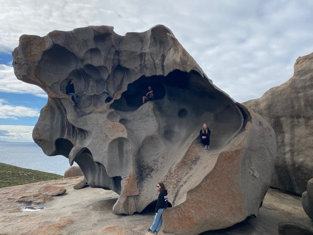
The next day was spent exploring Flinders Chase park. The aptly named Remarkable Rocks are indeed, quite remarkable.
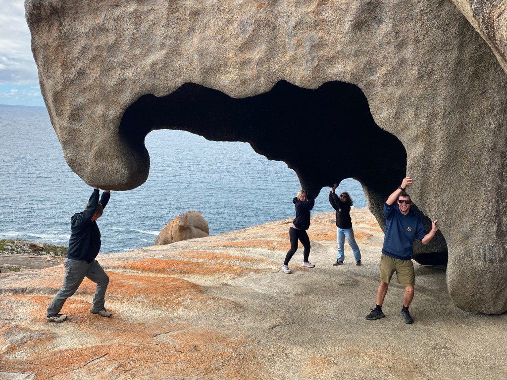
Australians joke that they are not the most creative in naming of places – Blue Lake, Remarkable Rocks, Long Beach – at least you know what to expect! These almost surreal rock formations perched on a cliff above today’s ocean levels made for playful exploration. The rocks are sculpted from ancient granite formed over 500 million years ago, then shaped into their captivating forms by millennia of wind, salt, and rain erosion.
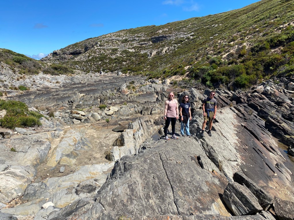
Next stop, Admirals Arch Boardwalk, a short pathway down to fur-seal colonies, where one large male seemed to strike a pose for the camaras before attempting to launch himself onto a large rock repeatedly, then swam away embarrassed.The Snake Lagoon Walk took us through coastal brush, along a dry riverbed with sculpted rocks, out to a secluded pocket beach with impressive waves rolling in.
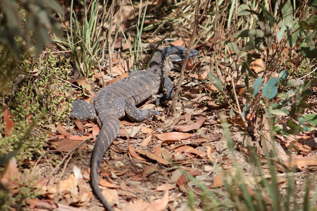
We dipped our feet, made sand shoes, rested in the sun, drew pictures and crafted animals in the sand, tried to catch tiny lizards; in other words, we played. We met a new creature, a “goanna,” which refers to large monitor lizards, agile predators that can climb, swim, and scavenge across a wide range of habitats. They are not poisonous, nor do they attack people. I like them already.
We moved to Vivonne Bay Campground and settled in for a mellow night. After our plague of millipedes the night prior, I still wasn’t prepared to watch a large fly land on my dinner and produce a large number of wiggling maggots straight out of its body. Straight out of a horror movie, these Australian flesh flies don’t lay eggs like most flies; instead, they use ovoviviparity, meaning the female deposits live maggots (larvae) directly onto food, carrion, or waste. This gives their offspring a head start — the maggots begin feeding immediately, which is why you might suddenly see larvae appear on food seemingly out of nowhere. SO NOT COOL.
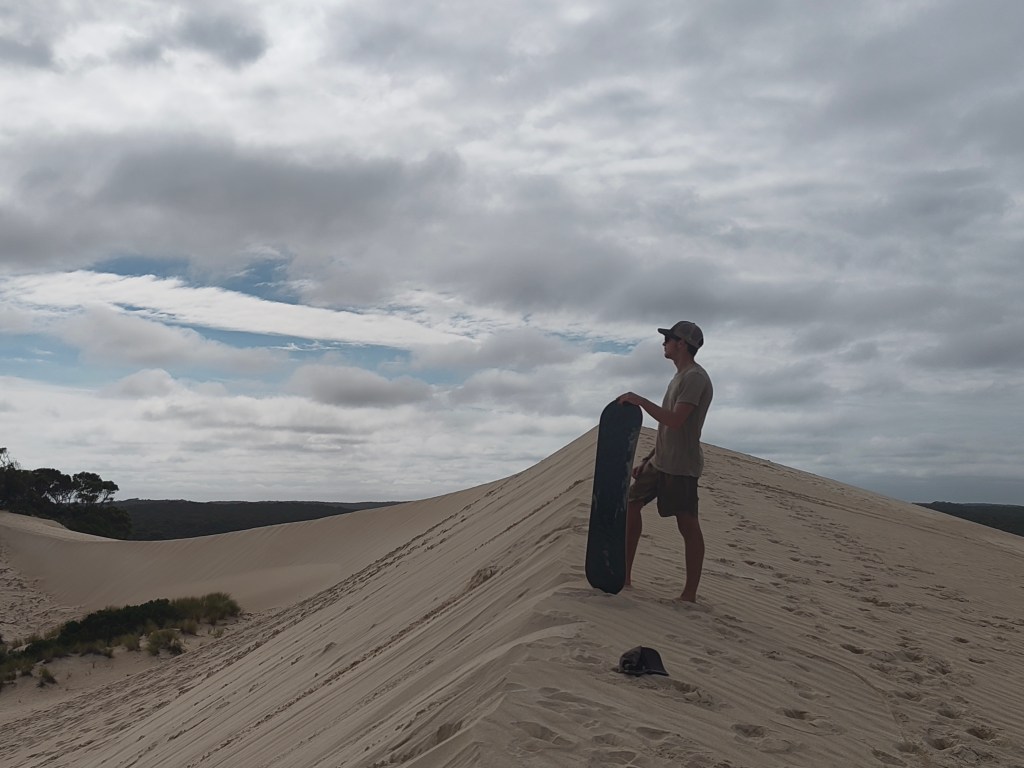
What do kids that grew up together snow sledding in Alaska do when presented with the sand dunes of Little Sahara? Sand sled races!
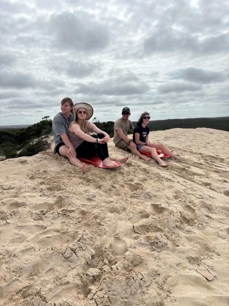
It was a tight competition, as the doubles teams of Calder/Cora took on Gabriele/Elijah, gaining strategy over the morning. The parents also competed. We attempted sandboarding as well and left both sweat and blood on the dunes that day.
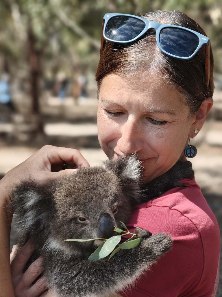
We had some special animal connections at Kangaroo Island Wildlife Park, as Gabriele and I held baby koalas which are indeed as soft as they look, as I cuddled my face into the fluff, the smell of eucalyptus strong as the little fellow munched away.
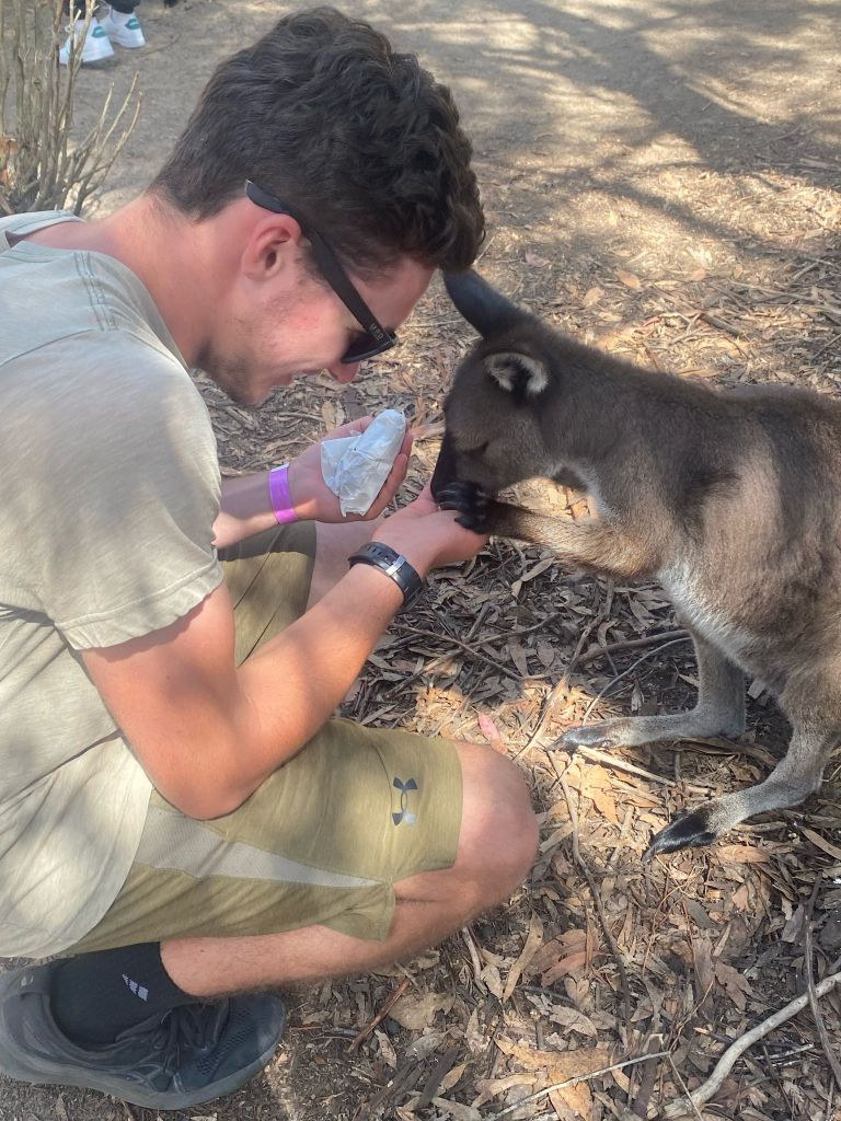
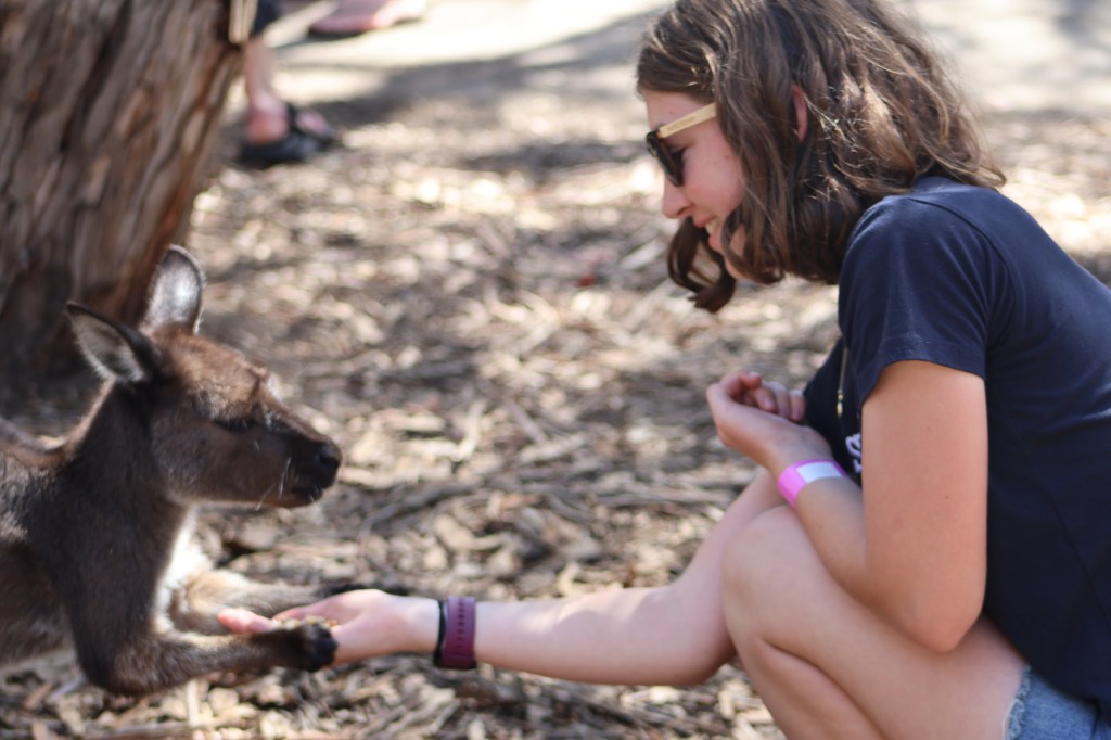
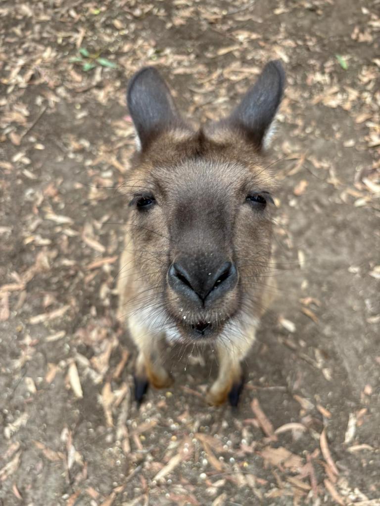
Calder, Chris, and Cora held paws with a Kangaroo Island kangaroo, as the ‘roo nibbled from their hands. Seriously adorable.
At Antechamber Bay Campground in the Lashmar Conservation Park, we camped in beautiful coastal bush by the Chapman River, a mama and baby possum cuddled in the bathroom rafters, an echidna wandering through camp, pelicans out by the bridge. I found this setting quite captivating, the confluence of bush, river, and ocean.
After a peaceful morning walk to the viewpoint with a cup of coffee, we were on our way to catch the ferry from Kangaroo Island back to the mainland. The Jucy campervans were packed like sardines into the hold and we wondered if they touched, as the motion of the ocean was a mix of various swells and wind waves. Let’s just say a second cup of coffee didn’t sound good, as we had decidedly left our sealegs back on Terikah.
After turning in the trusty green machines that treated us so well, we slept in an Adelaide AirBnB to “reset” for a night, eat our remaining food (egg burritos and lots of carrots for dinner), and do some laundry. We leave for Alice Springs in the Outback tomorrow morning. There has been extensive, ongoing flooding and many of our reserved campsites and planned hikes are currently inaccessible due to stream levels and damage. This will be the ultimate Outback adventure of flexibility!

One response to “Australia Part 3: Melbourne to Adelaide JUCY Roadtrip”
What fantastic descriptions and info. Except for the millipedes and “interesting” fly you made me want to be there! Thanks for the pictures and wonderful blog. I’m sending this one to our friends in Australia. They will love your appreciation and true interest in their country. ❤️
LikeLike