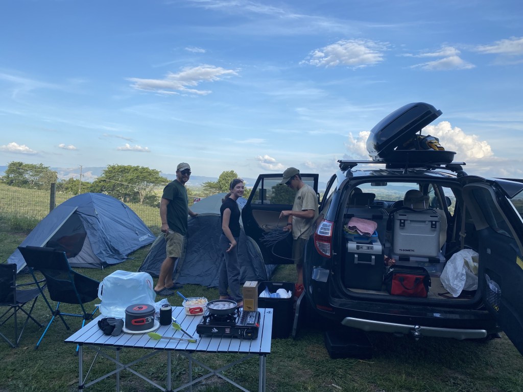
We head out on a 2-month New Zealand road trip, a combination of tent camping, caravan-towing, and Air BnBs. The car packed to the brim, we left only one hour after planned…on our 5-hour drive to Hobbiton in Matamata.
Hobbit: “Bilbo, where you off to?”
Bilbo Baggins: “I’m already late.”
Hobbit: “Late for what?”
Bilbo Baggins: “I’m going on an adventure!”
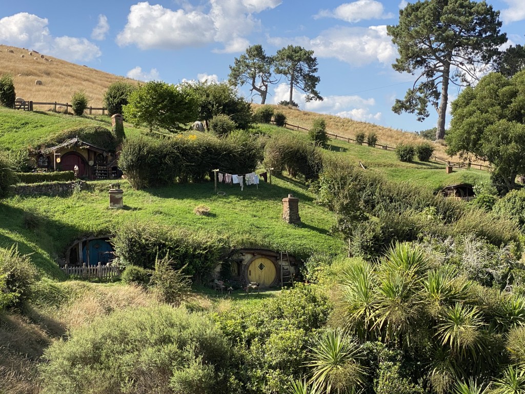
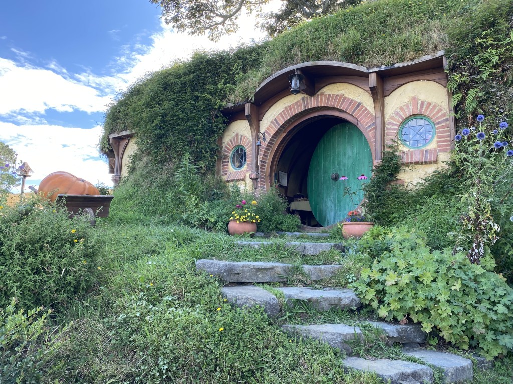
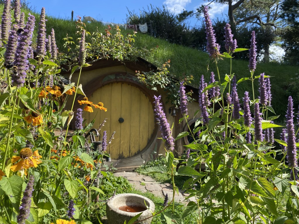
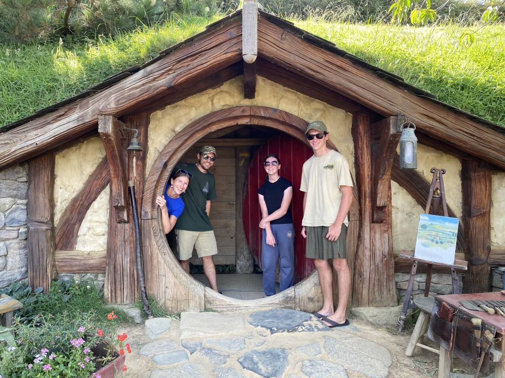
Our family has gotten into JRR Tolkien’s Hobbit and Lord of the Rings books/films and are taking the opportunity on this road trip to dive into the various film sites. Hobbiton was constructed in 1999 for the Lord of the Rings trilogy, completely taken apart, then permanently rebuilt for the Hobbit trilogy in 2009. The tour through the Shire led us past a variety of brightly colored hobbit doors nestled into the lush peaceful setting, amazed at the miniscule details throughout and inside one hobbit dwelling. Scenes came to life – the bridge near the Millhouse where Gandolf crossed, the green door of Bilbo and Frodo’s Bag End, the yellow hobbit home door that Sam closed on Bagshot Row at the conclusion of the film series.
Cider and ginger beer at the Green Dragon topped off the experience. We have never been on the actual set of a movie and the loving care and passion that continues to go into the hand-built details of the Shire is obvious, months of creative details put into only 5 seconds of movie.
We set up our tents only two miles away at Brock’s Farm overlooking the rolling farmland, a chicken begging for bites of our dinner, before we tucked into our own hobbit tents for the night.
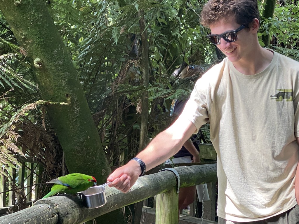
Woke to heavy fog, packed up and on our way to Otorohanga Kiwi House and Native Bird Park, where we watched kiwi close up in a darkened enclosure, as well as saw and learned about kea and kaka (native parrots), morepork, tuatara (lizards), and fed kakariki (native parakeets).
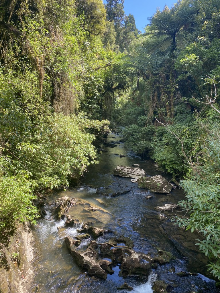
Drove just a bit further to Waitomo (Māori word meaning “a place where water enters the ground”), where we hiked the Ruakuri Bushwalk. We are now in karst landscapes, with the entire Waitomo Region based on limestone rock thrust up from the ocean floor millions of years ago.
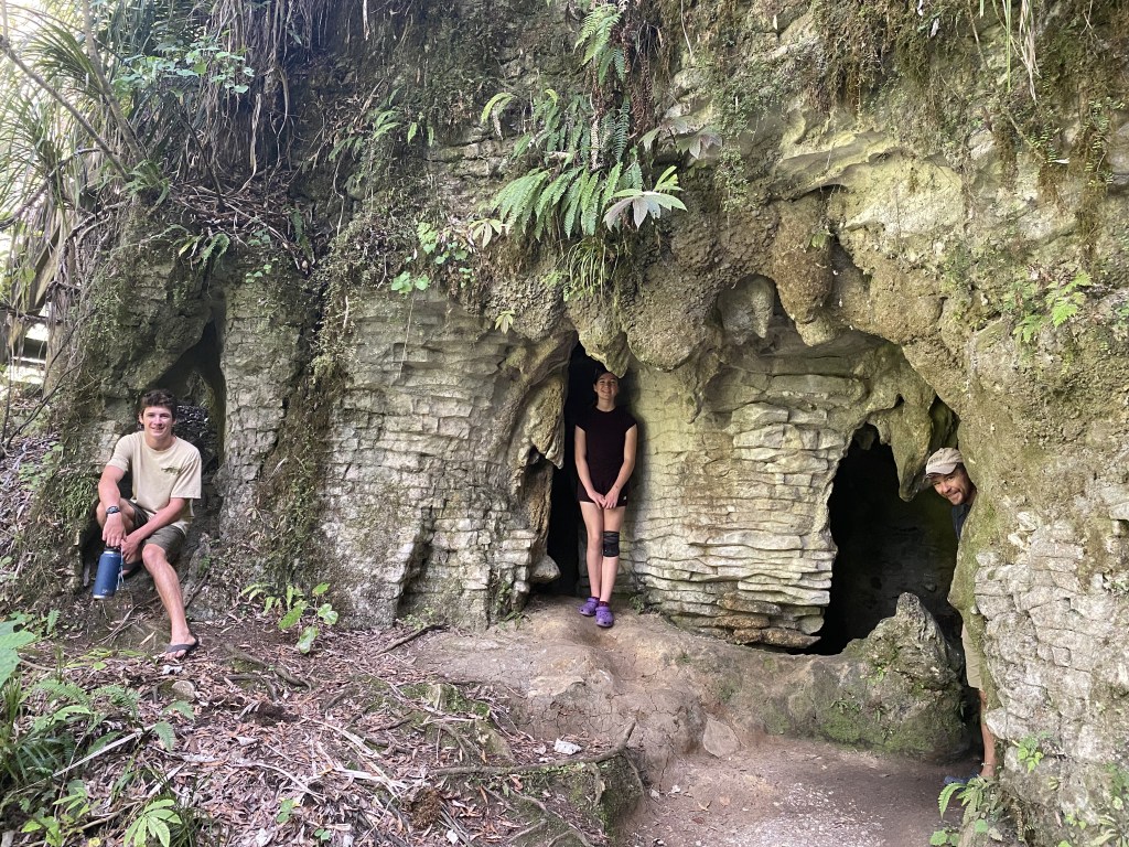
Walking the trails, rocky structures seem to rise out of the lush bush and farmlands, with a dark world of caves and tunnels hidden inside the hills.
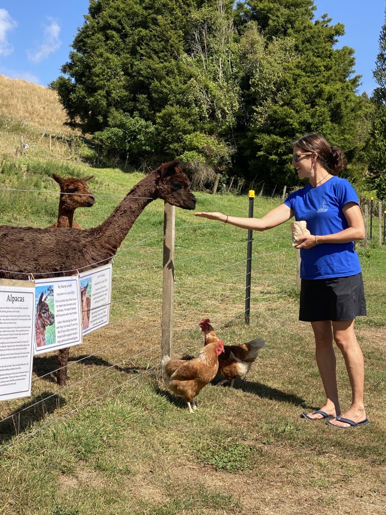
Staying at the Top 10 Waitomo Holiday Park (with its picnic tables and lawn chess set) is not our normal isolated Alaska camping scene but is quite convenient and comfortable. Also, it is adjacent to Happy Hooves Farm where I realized that I never get tired of wandering farms and hand-feeding the goats, sheep, and alpacas; not sure who likes it more, the kids or I, as I picked up and cuddled a chicken. We just may have visited more than once…per day. And Cora and I just may have memorized their names, from Sherlock the sheep to Raff the alpaca.
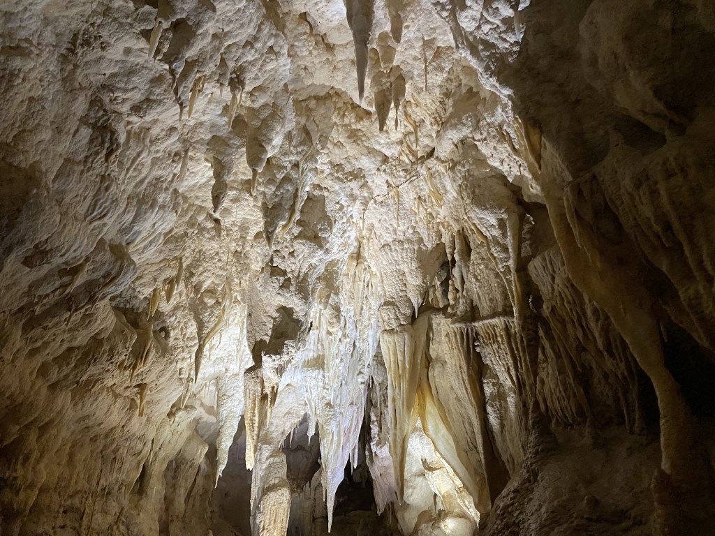
This region has over 300 caves and we signed up to explore two of them. Briefly, caves are formed by the dissolution of limestone. Rainwater picks up carbon dioxide from the air as it percolates through the soil, which turns it into a weak acid. This slowly dissolves out the limestone along the joints, creating planes and fractures, some of which become enlarged enough to form caves. The first cave we toured was Ruakuri Cave with its magnificent stalactites, stalagmites, stalacmates (so cute – when they meet together!), bacon (the NZ word for curtain formations), and seashell fossils.
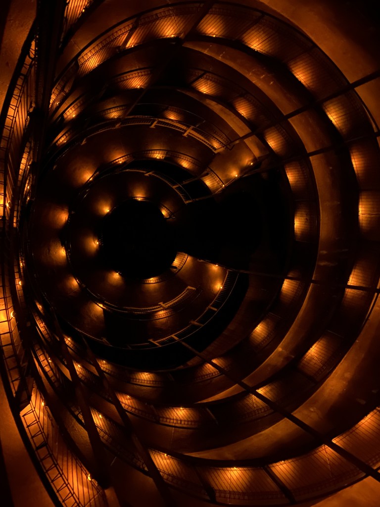
Almost equally impressive is the visitor structure built intimately inside the cave, spiraling stairs downward then walking on elevated walkways, all brought in and built by swimming in, piped from above, and climbing down.
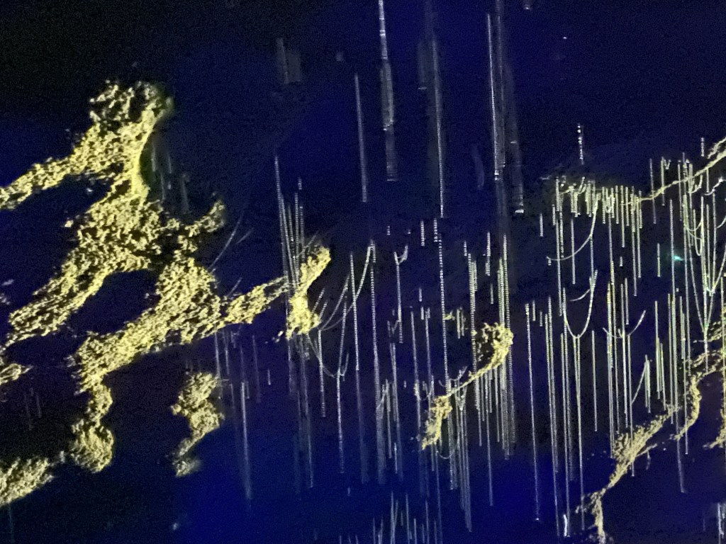
One favorite moment was seeing the shimmering reflection of the glowworms in the cave’s river. The old infrastructure from the early 1900’s is still in place in areas, the original entry now closed off to respect the sacredness of this entrance to the local Māori family that owns the land. After we enjoyed local brew and lunch at Huhu before a bushwalk and exploring the local museum, where we just had to crawl through the cave simulation.
Next stop, the famous Waitomo Glowworm Caves, where our Māori tour guide sang a beautiful song with the lights off in the cave’s cathedral, followed by loading into a boat that she pulled silently over the cave’s river with a glowworm constellation above. As magnificent a site as glowworms are, here’s a bit to ground us in reality: These are fungus gnat maggots that glow brightly to attract food to their fishing lines of snot and urine hanging down that ensnare them where they suck out the juicy insides. Eventually, the maggots turn into flying gnats, mate wildly for 3-5 days, lay eggs, and die exhausted. When they hatch in groups, they get a bit hungry and get entangled in each other’s lines, eating each other. Hmmm, now back to the magical display.
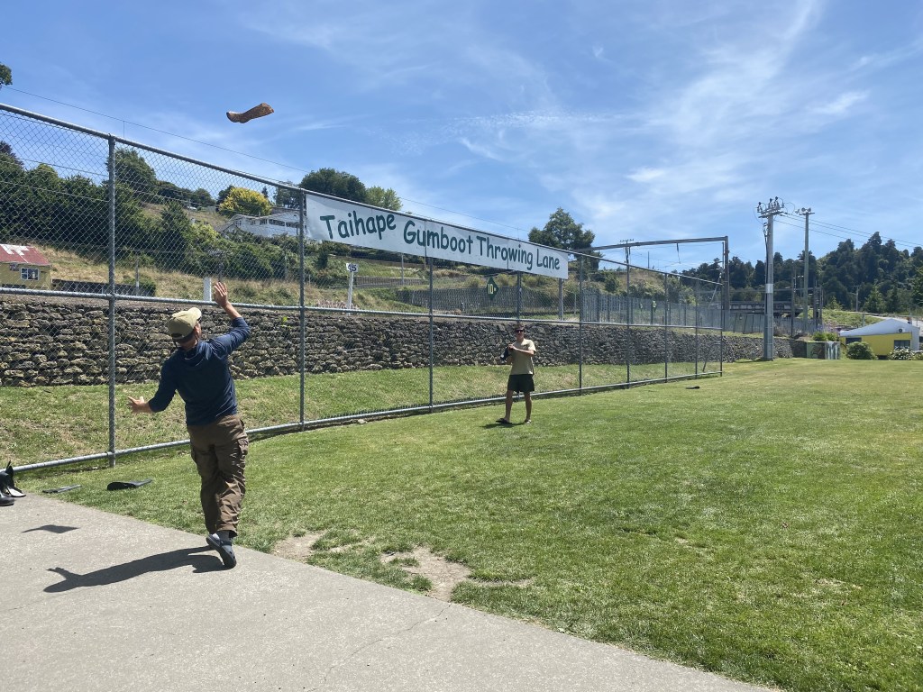
Packed back up and on a long day of driving, stopping for lunch at a picnic table in Taihape where we threw gumboots down the Taihape Gumboot Throwing Lane, Calder’s 25 metre throw the best of our family.
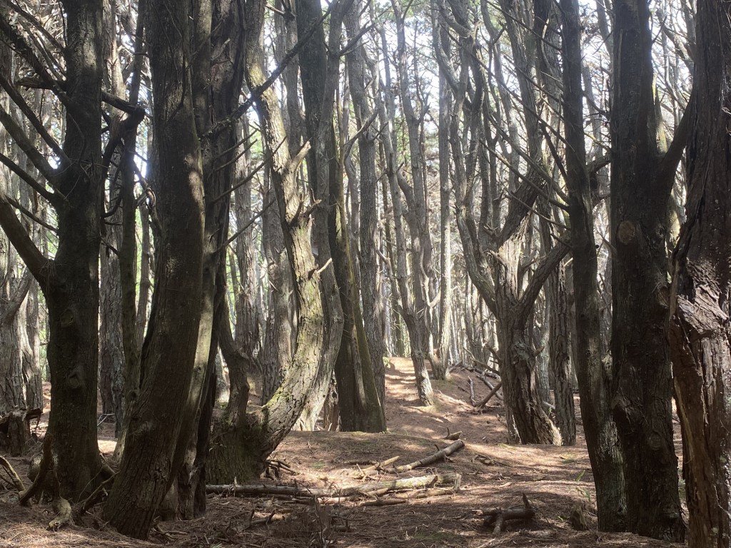
Next stop Waitarere Forest, otherwise known as Osgiliath Wood in the Lord of the Rings where Frodo, Sam, and Gollum walked after leaving Faramir in the Two Towers. Walking through, we could picture Gollum scampering among the dark tree stumps.
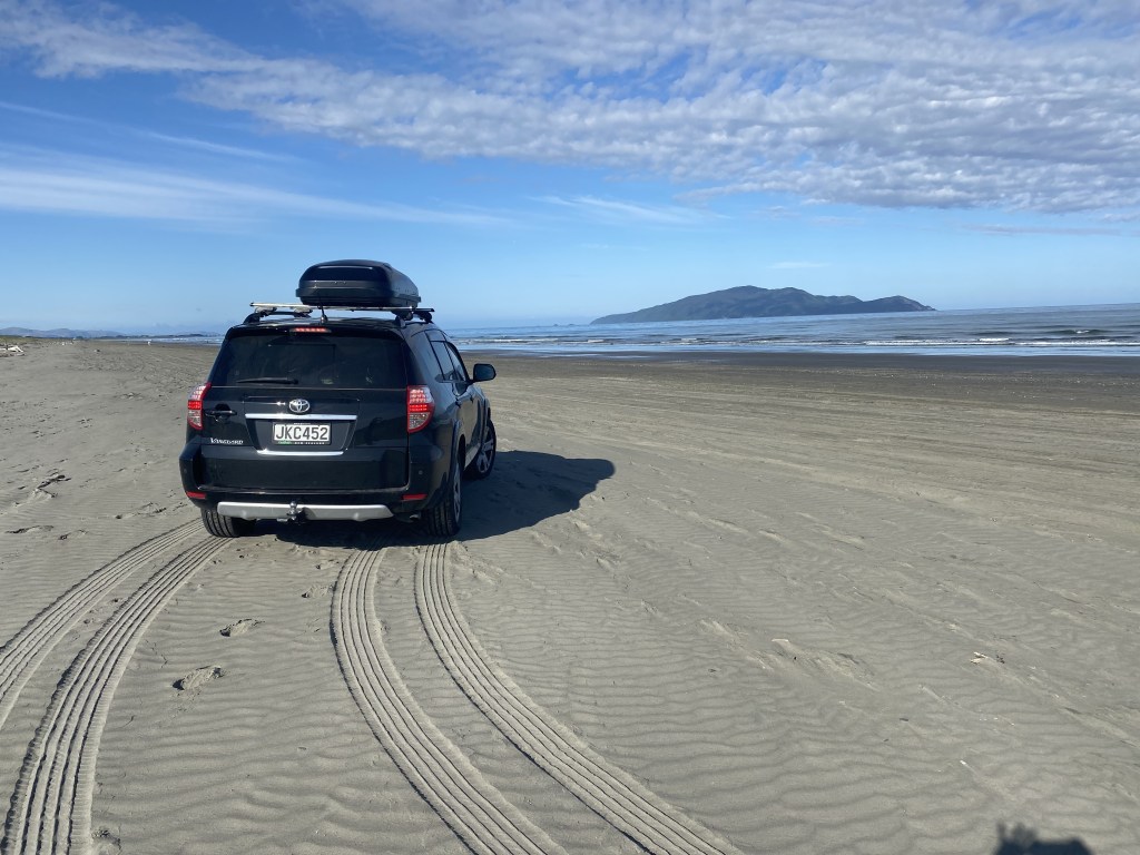
Five hours after starting out, ended our drive at an AirBnB at Te Horo Beach that backed up to gardens and horses grazing in a field, gentle slopes in the backdrop. It was a very peaceful place to spend the night before our ferry the next morning out of Wellington to Picton on the South Island. The Tasman Sea felt warm as we walked amongst massive piles of driftwood, speaking to the Sea’s tendency to be feisty on this western side of New Zealand. In the morning we even drove along the beach sands, a novel experience, before heading to Wellington.
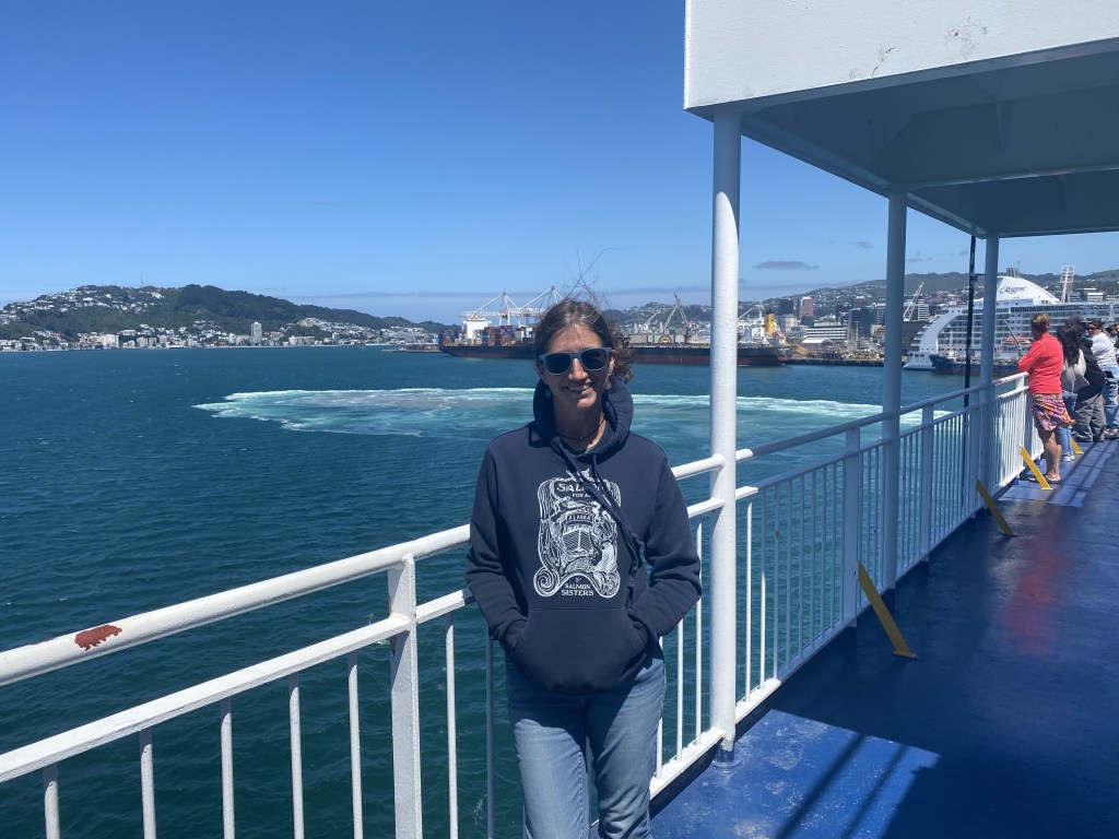
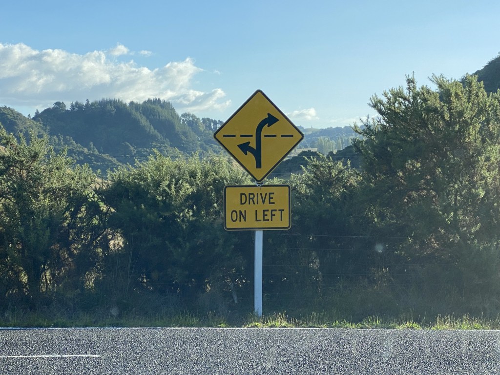
Off to Wellington to get on the Interisland Ferry and cross Cook Strait the 52 nm to the Picton through the fjords of Marlborough Sound, feeling the ocean swells.

Just like the Alaskan Ferry, this one served good French fries, but there was also an announcement at 4pm that it was hot scone time, yummy!
This was the only night I hadn’t planned a place to stay out of our entire 2 month trip, as there were many options along the way to Christchurch and I wasn’t sure how much Chris would want to drive before getting tired and wanting to stop for the night. Through vineyards along windy roads and stunning rocky coastline, it was only 6:30 so we decided to keep driving past the first coastal campground (which did indeed have room).
Laughed at small playful and sleeping sea lions (and pups) playing along the way. Took a side road to the DOC Campground Puhi Puhi to stay for the night and surprisingly found it full; the write-ups about this site were that usually there were none to one other camper there. No room for us. Hmmm, it was getting late and Chris was getting tired; decided to pull into a massive Holiday Park to set up our tent on a small piece of grass; no room, completely full. It was Waitangi Day weekend and many Kiwis had a 4-day weekend. Getting dark and now also after hours for many places, we pulled off to another campground but it appeared it was permanently closed. Dark and 9pm, we drove down the windy narrow roads past “No Vacancy” signs everywhere. Jumped on AirBnB and found a place close to us, but a miscommunication and lack of good internet made it seem not a viable option. Getting gas, looked across the street at a very sketchy looking Motel above a bar – Vacancy! No, the kids said, not even believing we’d consider it. Now 10:30, we’d driven the entire way to Christchurch; not the plan. Crashed at a hotel for the night, ordered room service, and slept great.
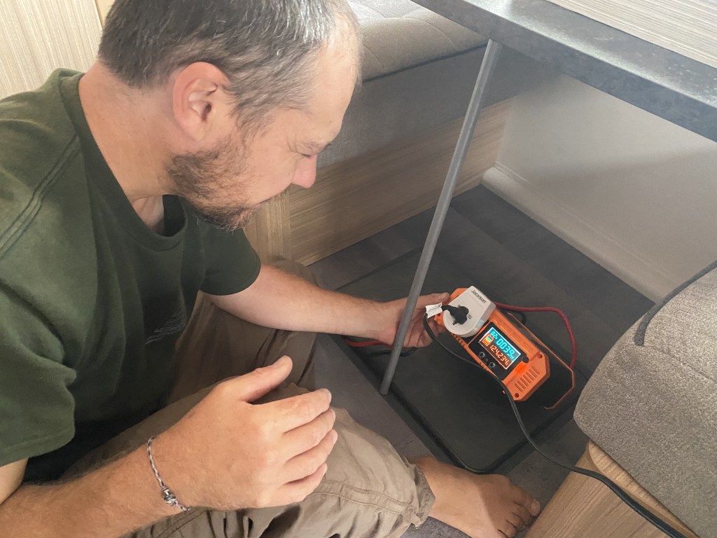
After our unexpected luxurious night of sleep in a hotel, we ran errands to pick up parts for our caravan’s electrical system (Chris converted 110 V Starlink to 12 V for school use), grocery shopping, and to pick up our caravan for the next 6 weeks travel.
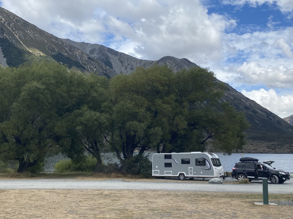
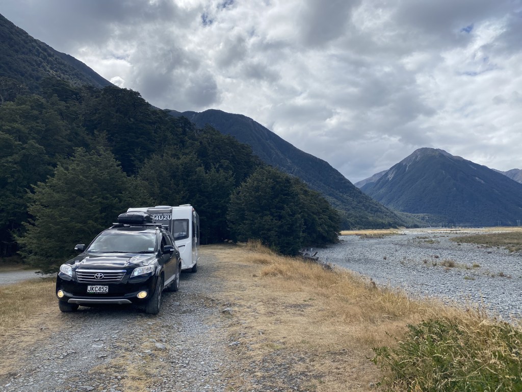
The 20-foot caravan dwarfed our little 12-foot SUV, as we headed out to the Arthur’s Pass region, our car straining (and smelling a bit hot) up to the top of Porter’s Pass (3,130 feet). Stopped at Lake Pearson (Moana Rua) DOC campsite for 2 nights.
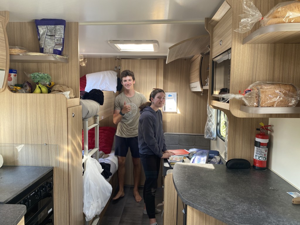
Arthur’s Pass National Park straddles the Southern Alps, this vast alpine wilderness becoming the South Island’s first national park in 1929. It is a rugged mountainous area, cut by deep valleys, and ranging up to 2,408 metres. Moving into our caravan (our Hobbit home we call it), we are figuring out spaces and how to live day to day, which for me means cooking meals. Luckily for us, we are used to living in small spaces, and we find this living quite cozy and comfortable.
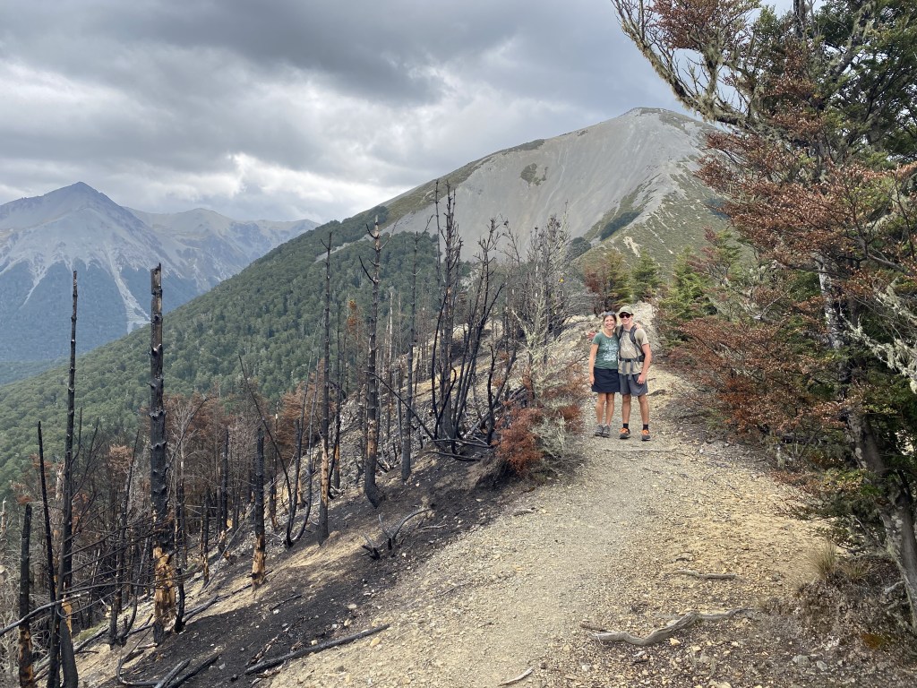
Off to Mistletoe Track to Helicopter Hill hike, slowly meandering up through the woods, then up some loose scree to the top where we were rewarded with great views, considered a “moderate tramp.”
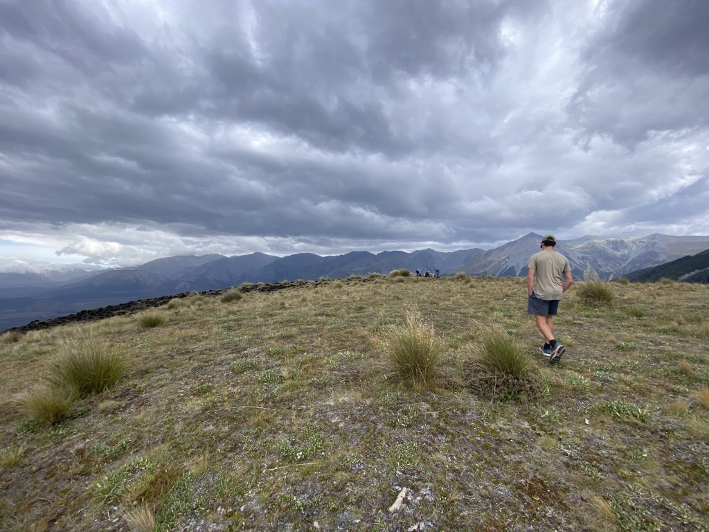
There are walking trails (very easy meanders), moderate tramps, and challenging tramps (often multi-day). The track out wandered across an apocalyptic forest of blackened forest fingers reaching up from the dead dirt, not a bit of green yet poking through from the recent fire.
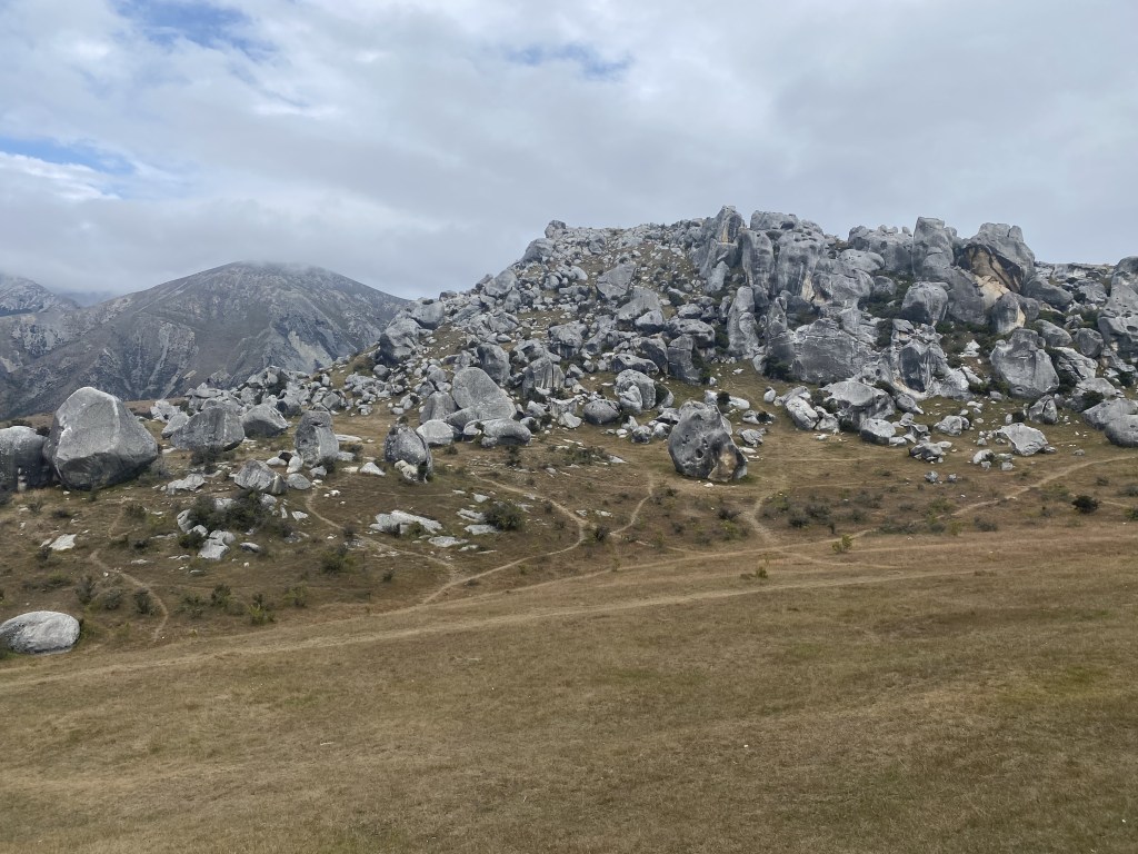
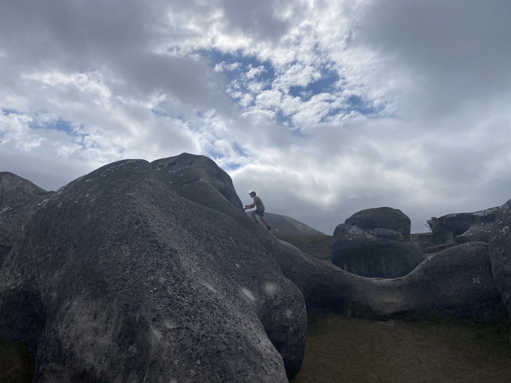
Castle Hill (Kura Tawhiti) is a collection of limestone formations up to 30 meters high, looking so other-worldly that they were named “treasure from a distant land” by early Māori. We were enthralled walking and playing amongst the massive outcroppings.
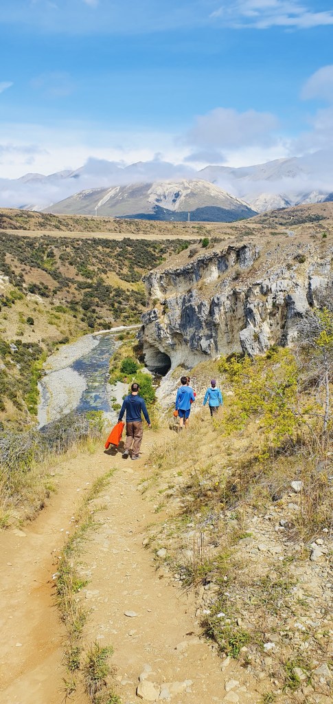
Next, we had a “teaser” as we walked a short loop around the Cave Stream Scenic Reserve, reading the guidelines about the best times and conditions needed to hike the 594 metre long wet cave. Needed: a foolproof torch and warm clothing, and definitely only if the water level is less than waist deep where indicated. Heed all notices. Contemplating returning tomorrow. The limestone formations here were featured in the Chronicles of Narnia movies.
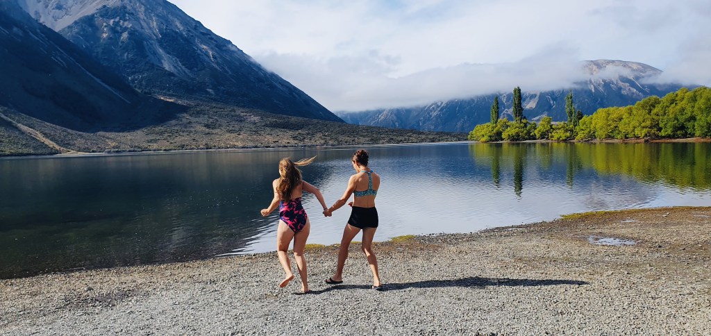
Dunks & Spelunks: After a morning dunk in Lake Pearson (brisk, but refreshing!), we did indeed head back to Cave Stream Scenic Reserve to see if we were spelunkers.
We donned our warm tops, hats, and headlamps, knowing that everything below the waist would get soaked, and headed into the wet cave against the flow of the river.
The initial dip was above the waist, but varied throughout the cave, some challenging parts going up swift waterfalls. Turning our lights off together, the darkness was complete. We’ve never hiked through a wet cave and it was awesome to see the power of water carving out the passageway we hiked through. A bit eerie at time with small eels in the water with us, spiders on the walls, the echo of rushing water around us. We climbed out the steps bolted into the wall and slid our way out the final passage one hour later…then grabbed Cora to do it again. We had checked it out prior to ensure it was okay for Cora’s knee and she wanted to give it a try. Cora’s determination and Calder’s kind coaching in helping her get through were the highlights of my day.
After, we moved to Klondyke Corner Campsite near Arthur’s Pass, where we found a site perched over the massive Waimakariri River valley.
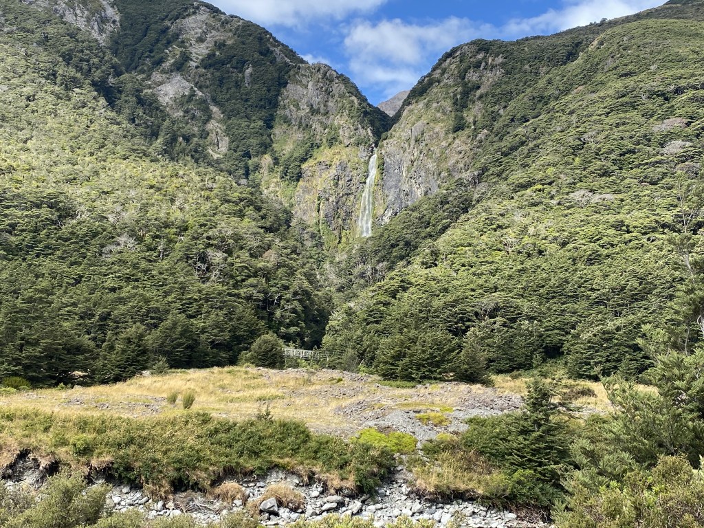
Had to get one more hike up to the 131 metre Devil’s Punchbowl Waterfall before tucking in for the night, rain moving in.

11 responses to ““I’m going on an adventure!””
Leo and I just toured the Waitomo Glowworm Caves today! We’ve been exploring the north island for a few weeks now. Headed to the south island tomorrow. Maybe our paths will cross!
LikeLike
Isn’t this a beautiful country?! Would be wild if our paths crossed. Enjoy!
LikeLike
Happy New Year to everyone! We so enjoy hearing about your adventures! Just wanted to jump on and wish you all well and thanks for keeping us posted. The Gillespie’s ❤️❤️
LikeLike
Thanks! We feel so lucky to be doing this journey!
LikeLike
What a great adventure! Thanks for sharing!
LikeLike
We’re loving reading your travels! A once in a lifetime adventure. 🥰❤️
LikeLike
We’re loving reading your travels! A once in a lifetime adventure. 🥰❤️
LikeLike
We’re loving reading your travels! A once in a lifetime adventure. 🥰❤️
LikeLike
Love reading your journal and a tad bit jealous! I was in NZ 40 years ago with my mom, absolutely gorgeous country and lovely welcoming people!
LikeLike
You’re bringing back memories of my working holiday in NZ in 1966-67 although you seem to be finding many more attractions than I did. NZ is a magical country. If you get the chance, check out Farewell Spit or at least the beaches on the northern tip of South Island. It’s near where one of my jobs was in the town of Collingwood. I think Farewell Spit is a National Park now, but back then it was mostly undiscovered.
LikeLike
stay safe! Wonderful adventures 💖
LikeLike