The winds and swells are unfortunately from the SSE, which is not conducive to the passage. We are heading a bit too much westerly and hope to make this up and drop south in the next 24 hours when the winds and seas calm. It is quite a bumpy ride today and we are heavily reefed down. We took our Marquesas flag down, as we left the Marquesan waters. It now hangs next to the tattered Mexico courtesy flag on our wall.
The seastate makes it challenging to do much beyond watching the sea and doing watch. We pass the time listening to music, reading, and audible books. The guys are able to package up the wahoo we caught, but Chris is a bit green as he emerges back into the cockpit. I made dinner in stages to avoid being in the kitchen too long at once; quite the step-wise process but it ended in yummy basil, spinach spaghetti.

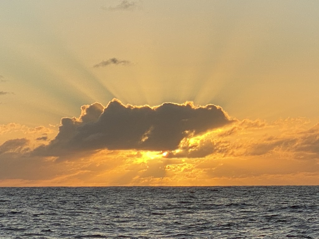
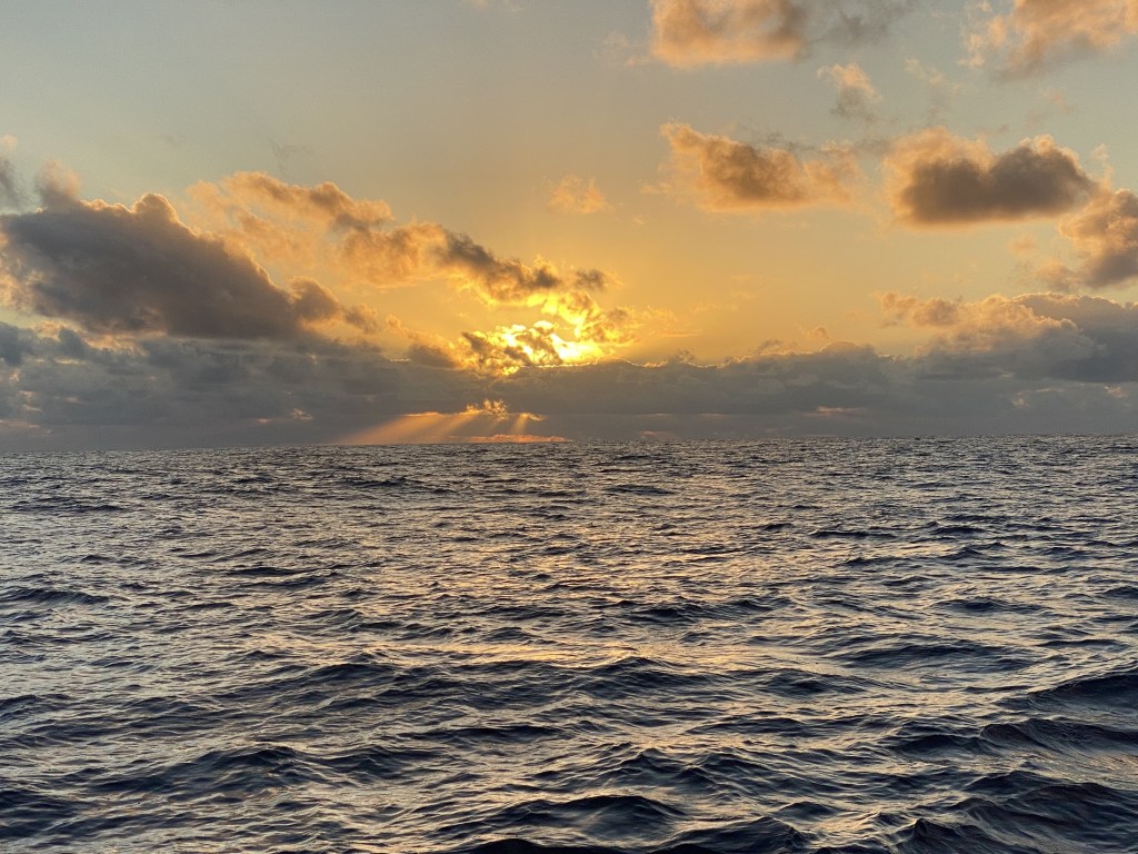
Overnight, the seas and winds decreased by midnight and this morning, still lovely seas and lighter winds; we sail along slowly and comfortably. Winds decrease further and we decide to motor for a bit in order to ensure our arrival in time to go through the pass. At 6:30am, Chris wakes us up for our entrance to our first atoll. The atolls look like little turtles of vegetation lined up on the horizon, so flat compared to the Marquesas.
We had arrived at the Tuamotus – 458 nm!
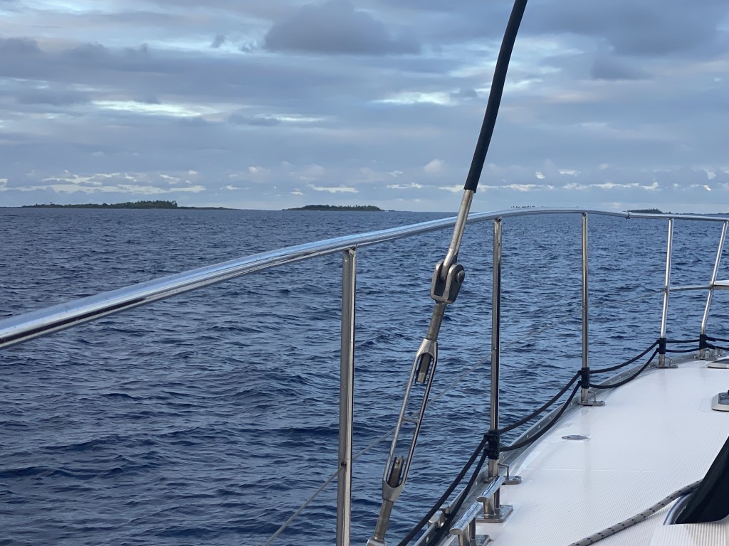
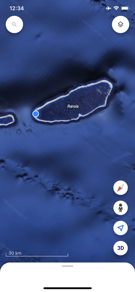
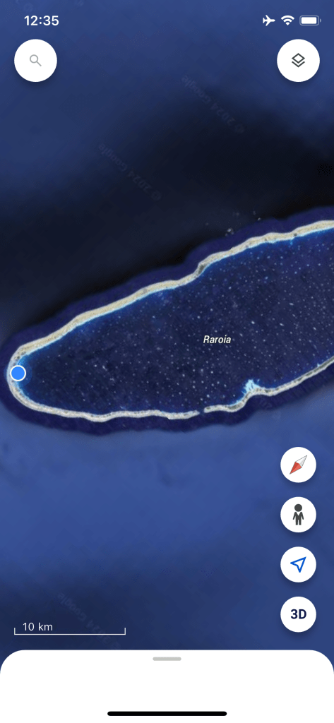
Raroia is our first Tuamotu atoll and has quite a bit of vegetation (unique to these atolls) and only one pass/entry (Passe Garue/Ngarue – North Pass), about midway down the western side. Tidal streams and currents can reach up to 8 knots and slack water is usually of short – or no – duration here. We arrived about 1-2 hours after low tide, sized it up for a bit, then went for it – still with 1-2 knots of current against us.
It was early in the day and it was mostly cloudy, making visibility poor. We crept over to temporarily anchor just inside the entrance and wait for better visibility, when the sun is higher in the sky.
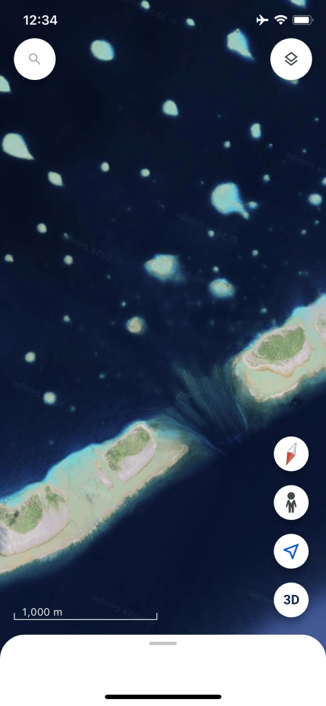
This is our first time sailing among coral; quite nerve-wracking with recent tails of two boats we know hitting coral this week. We crept through, using satellite imaging and three of us on the bow looking out for the telltale sign of water color change indicating coral heads. After a brief anchorage, we head to the safety of the windward side of the lagoon. Thankfully, cruisers help each other out by sharing “tracks” they used to get safely through the atolls and we have such a track. We use this as a guideline, along with satellite images and eyeball navigation, making our way 7 nm across the atoll at 2-3 knots of speed.
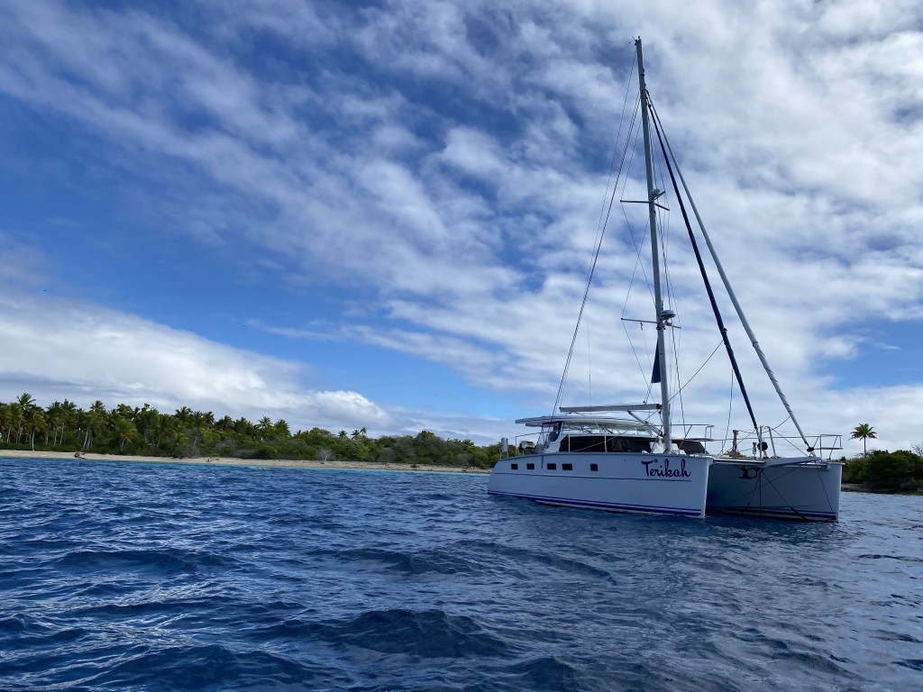
We anchored in 20 feet, sand bottom, with coral heads surrounding us outside of our swing room.
To recap, where are we exactly? We sailed from Mexico to the South Pacific Islands and are still in French Polynesia. French Polynesia is the size of Europe and made up of 130 islands in five archipelagos: Marquesas, Tuamotu, Society, Gambier, and Austral Islands. French Polynesia’s status as an overseas territory of France was changed to that of a French overseas collective in 2004. We are allowed a 3-month stay here. The cyclone season is November to April here, but fully-fledged cyclones very rarely affect this area, the risk highest during El Nino years. We spent the last month in the Marquesas and have arrived to the Tuamotu Islands. For us, the rugged beauty of the Marquesas will hold that dear spot in our heart of the first land after our crossing.
Whereas the Marquesas are lofty awe-inspiring volcanic mountains rising from the sea, the Tuamotu Islands are in complete contrast with 76 low-lying coral atolls, crystal clear waters fringed by coconut palm coral beaches, covering a land area of 343 square miles, but spanning 1,000 miles. They spread across 150 degrees longitude. Each atoll is a ring of coral, topped with occasional motus (sandy islets), surrounding a lagoon. The motus on the reefs are clustered to a greater degree on the northern and western sides, while the southern sides are often bare, awash coral reefs. This is the largest group of coral atolls in the world! They were once called the “Low or Dangerous Archipelago” on account of their hidden reefs and treacherous currents. Negotiating the passes into the lagoons can be tricky due to strong currents. Navigating inside the lagoons is tricky as well, studded by coral heads.
It is best to enter the atolls near slack water and with the sun directly overhead or behind the observer so the colors of the water can give an indication of depth. We explore new resources, such as the French Hydrographic Office (SHOM) for accurate tide tables in the area. There is also a spreadsheet created by cruisers called the Guesstimator that provides information as well. However, all agree that the best is to get to the entrance early and just watch for a bit to ensure good conditions. The atolls are visible only when less than 9nm away.
These islands are the home of the Puamotu people with income from fishing and copra (from coconuts) and pearl cultivation, with only 30 atolls permanently inhabited, total population around 16,000. Interestingly, France did nuclear testing starting in 1963 and not ending until 1996 (after the worldwide moratorium on nuclear testing) on the atolls of Moruroa and Fangataufa, areas now off limits due to the lingering threat of aging nuclear by-products still remaining and leftover construction supplies. Rain is the only source of freshwater. The soil is a stony coral and generally unsuited to growing vegetables or fruits, other than coconuts. Cruising boats must be self-sufficient in these atolls due to limited services, as they would for a long passage.
We are beyond excited about being in this extremely remote location, so surreal. We are also tired from the passage; good night!

4 responses to “Arrived Tuamotus!”
What an amazing location! Thanks for letting us have a look at it with you.
LikeLiked by 1 person
Congratulations on making it to the Tuamotus! Dick and I spent one vacation on Rangiroa about 20 years ago. We met some of the kindest people and experienced fantastic snorkeling there. Be safe with the coral heads. The overhead satellite images you posted make it look incredibly challenging to dodge them!! Love hearing your adventures. Thank you.
-Patti
LikeLike
Hi Patti and Dick – thanks for reaching out. It’s so nice to get comments from people along our way, helps us to feel connected to our boating friends from Petersburg and elsewhere! Yes, the people here are outstanding, so kind and generous. Entering and exiting each atoll and navigating sure is tricky, then we get to one and just want to stay a full week. We are going to 3 more, then off to the Society Islands.
LikeLike
WONDERFUL UPDATE! ❤️
LikeLiked by 1 person