
Upon arrival to Controleur Bay, we went up the now familiar river entrance at almost high tide on full step with SY Flora (yee-haw!) and strolled around town, picking up some produce and beer at the local Magasin. Enjoyed the full moon rising over the island mountains.

Dinner was exquisite – fresh tuna sashimi, a salad of mango and starfruit from Monet’s garden in Daniel’s Bay, and crisp cucumbers from Roger’s garden in Anaho Bay. I love when food is local and the story is known.

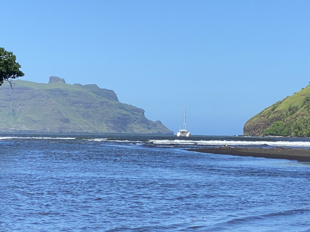
The following morning, as our friends on SY Flora left, they circled toward us and the sound of their conch shell echoed across the water; we hope to see them soon, but it may be many weeks or even a month from now. After school this morning, we went on The Great Panini Adventure. The last time we were here, my goals were: see tikis, hike to an archeological site, buy beer, and hike to a viewpoint where a food truck allegedly sold paninis. We did them all last visit…except the paninis, which I have been talking about since then! We had to go earlier in the tide than we would like, but made it over the narrow shallow river entrance and, with some paddling, to the dinghy dock.
Then up and up the hill we went to Belle Vue, a cute food truck run by a friendly local, where we ate paninis (a flattened baguette was used for the bread) and enjoyed the view before heading back to our boat.

On our way down, Cora spotted a papaya tree on the side of the road; no one’s property, all fruit trees here on the sides of the road fair game – up Calder went, climbing that tree and throwing 3 lovely papayas down to us.

Spent some time tonight working through the upcoming passage to the Tuamotus and figuring out the tides and timing of getting into our first atoll, downloading and studying some more resources for our upcoming month. We are in passage-readying mode, going to the “big city” tomorrow to fill our fuel, propane, and fridge. In the Tuamotus there is not ready access to any of these resources and we hope to be there for a month.
Taiohae, Nuka Hiva
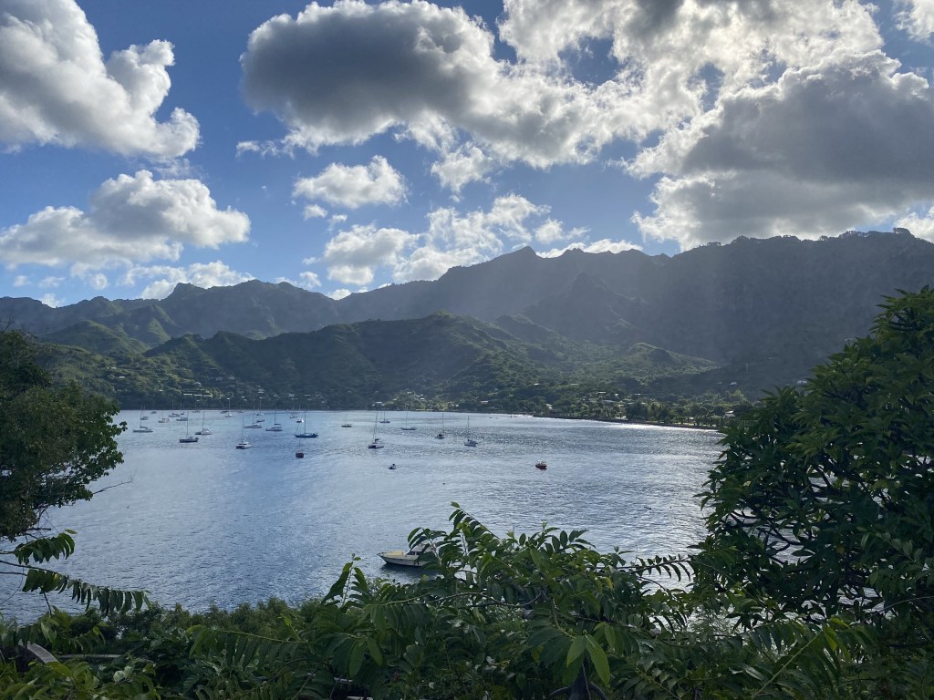
Taiohae (population 1,800) is the “capital” of the Marquesas, an exposed bay on the south side of Nuka Hiva, and has the biggest population and the most amenities in the Marquesas. We set our anchor down, along with about 50 other sailboats, delighted that it was not nearly as rolly as we anticipated from the reviews; the swell does indeed come in, but it is such a large bay and the catamaran gives us more stability. The boats here swing every which way at different times, nothing coordinated or predictable, but the bay is huge and this is not a worry. We sleep well.

The dinghy dock is an experience, as there are two ladders against a cement wall with a few larger boats tied up; the swell can cause the lines from those boats to lift up and damage one’s dinghy engine if they get too close. There are more dinghies than there is room, and they play bumper boats in the swell. We had a hilarious moment when we decided that we would just tie up at a less busy shallower area, as a wave washed into the dinghy…we realized why everyone was out further. Oh, well!
Our arrival on Saturday found a huge Marquesan festival occurring in town with dancing and music that we were able to enjoy. All the stores were closing early and wouldn’t be open until Monday. We wandered through town and did two provisioning trips back and forth to our boat, thankful that our visit here was timed just after the Arunui. The Arunui is a ship that runs a 14-day voyage from Tahiti through the Tuamotus and the 6 inhabited islands of the Marquesas, supplying these remote islands since 1984. The ship unloading and loading freight is a major event on each of the islands. We found almost every item on our grocery list, including fresh produce and eggs.
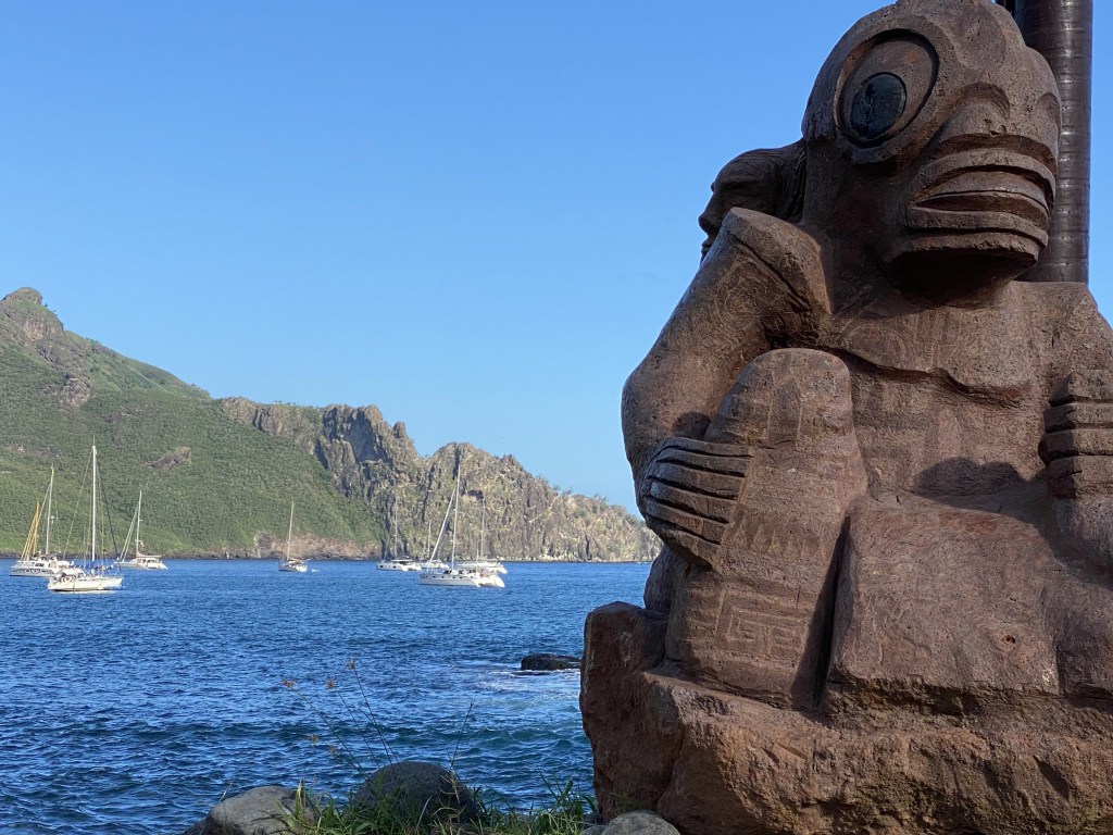
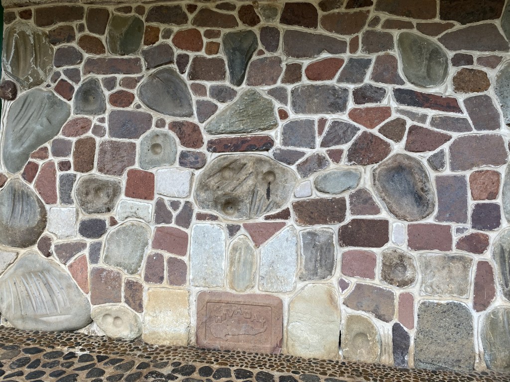
We walked through Pae Pae Piki Vehine, an archeological site on the waterfront that was rebuilt for the 1989 Marquesas Festival. This pae pae (traditional meeting platform) contains modern sculptures and a dozen magnificent tiki made by the island’s artisans and those from Easter Island.
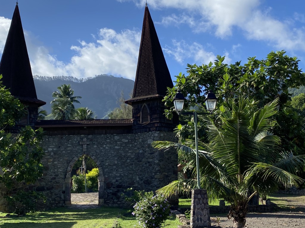
I woke early to attend the Sunday church service at Notre-Dame Cathedral of the Marquesas Islands, a striking building on a former sacred site, of stones from each of the archipelago’s 6 inhabited islands. Inside, there are numerous carved religious figures, combining Catholic and Marquesan symbolism. I attended the 8am service where I soaked up the hauntingly beautiful harmonies, following along with the mix of French and Marquesan languages in the songs and readings.
Our last morning in town, I found that the early bird gets the worm…in this case fresh lettuce (a rarity here), croissants, and breadfruit chips that we all love. We dinghied over empty fuel jugs and filled up with diesel and gasoline, as well as picked up our filled propane container (now with butane). I pleaded my case (as the cook) to go out for lunch of pizza and beer at Moana Nui before we went to the more remote (with fewer services) Tuamotus.

Before we left, we were treated to our first siting of a massive manta ray, its white filter feeding mouth at least a foot long with his body over 6 feet from wing to wing… so striking as it soared through the water by our boat.
Back to Daniel’s Bay for two nights and day of boatwork before setting out to Raroia, Tuamotus, about a 450 nm passage. Chris is cleaning the bottom of the hull to maximize our speed and I am prepping food for the passage. Even though it will only be about a 3.5 day passage, it is still important to analyze and pick the right weather window. We have some trepidation about bigger seas in the beginning and the need to also get tucked in before the SPCZ (South Pacific Convergence Zone) acts up, potentially reaching the edge of our location.
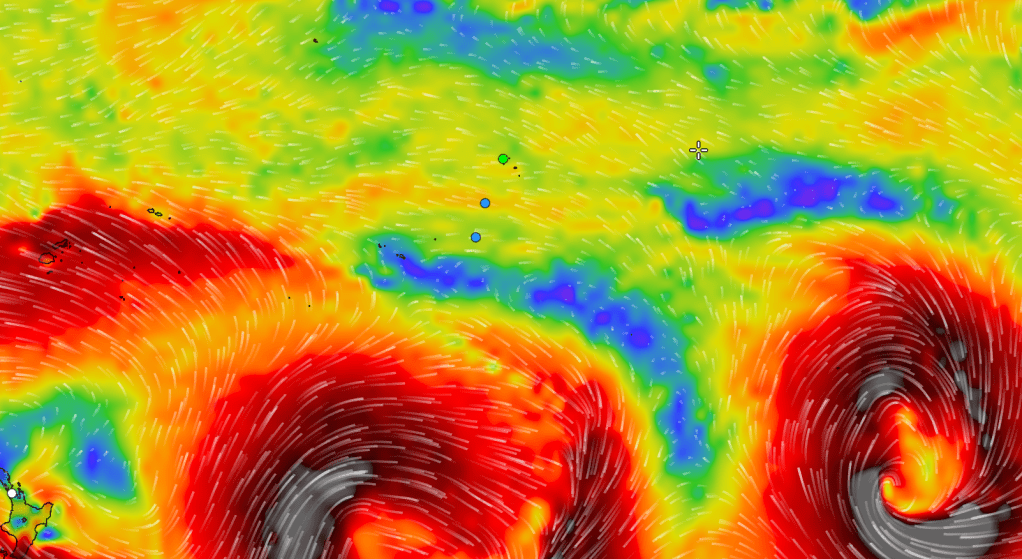
Getting into the various atolls requires careful timing, needing both near slack and bright sun overhead. The area is not well-charted and requires eyeball navigation around and in the atolls to avoid bommies (coral heads).

We are leaving tomorrow and we hope we have timed it right to get into the atoll with good sunlight on Sunday, then navigating up to the north end of the atoll to anchor. This is also our first longer passage with the kids taking watch together by themselves.
